


Morning
We wake in our romantic hideaway, high in the hills on the edge of the Knuckles Conservation Forest. Breakfast comes with views over tea estates and jungle, set to the sound of morning prayers drifting up from Bambarella in the valley below. We could sit here for hours, but today’s plan is the Knuckles Five Peaks hike.
The websites of local guides offering this hike are thin on detail, so we pieced together our own plan from the few scraps of information out there. Maps helped most: from our side of the range, specifically near Knuckles Waterfall (about 1,300 m a.s.l.), a trail climbs toward the Knuckles summit. We steer the tuk-tuk to the falls.
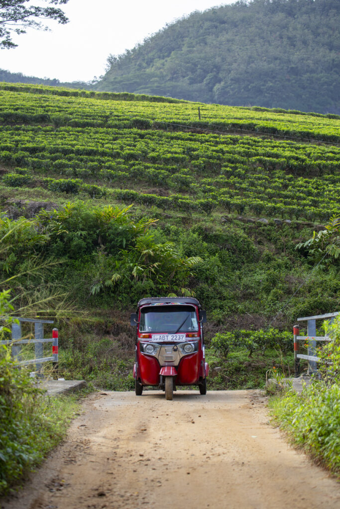
The road is fairly smooth for the first half, then turns rough with a few fords to cross. Where the track bends sharply, we decide to park the tuk-tuk and continue on foot. We later see a few tuk-tuks have made it higher, but it feels like the right call—the road is steep and badly chewed up by recent rains.
After around half an hour on foot we reach the trailhead. A small booth stands here, and a park employee collects the entry fee. With plenty of gestures we ask about the route; from his smiles and pantomime we gather we’re on the right track and it should be a great day out.
A few metres further the path leaves the road and slips into the surrounding greenery. The start is sodden, but it soon firms up and carries on through dense, overgrown vegetation. I check the map on my phone more than once—the jungle seems intent on swallowing the trail whole.
Within minutes the route edges toward a nearby stream and finally leads straight to Knuckles Waterfall. It’s a small cascade spilling down a rock face; in the rains it must look far more dramatic. Sadly, there are the usual traces of careless visitors—litter on the shore of the little plunge pool below.
Complications
I hunt for where the trail continues but can’t find it. After a few minutes I suspect we missed a turn somewhere. We backtrack, scanning the thick growth for a continuation. And then it happens—something nips my calf. I look closer and, with a jolt, realise a leech has latched on. I flick it off quickly and we check each other over. It’s not a lone parasite; there are plenty, and some are already inching across our clothes toward skin. Thankfully we both set out in long trousers.
We help each other remove the little horrors and quickly adjust our clothing to make it harder for any more to reach bare skin.
I speed up the search and, about 100 metres back from the waterfall, find a discreet turn climbing steeply in exactly the right direction. It’s easy to miss, and we follow it up.
The ascent
The path crosses the stream a few more times. With little water running, the crossings are easy; finding the path again on the far bank isn’t always. The leech episode is still fresh in our minds. We treat the areas near water as the riskiest, avoid lingering, keep moving, and check our boots regularly.
Gradually we leave the stream behind and the trail climbs more steeply through drier, grassy slopes. The forest thins and the first shafts of sun reach us. After about half an hour we step onto a clearing and take our first break. We’ve gained some height and the first views begin to open.
After a short pause we continue on a clear trail towards the next treeline and re-enter thicker growth. The path is now well-defined. Watch your head—taller hikers can easily bump into low branches.
The map says we’re moving well and have the first half of the ascent behind us. After roughly another half hour we reach a junction where a path from the village of Thangappuwa joins. From here the climb steepens; at times it helps to grab nearby trees and rocks.
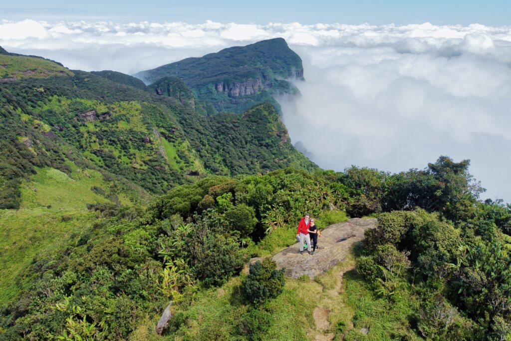
Vegetation still blocks most views, so we relish the moments when a rock outcrop sits right by the trail. It’s an easy scramble up for a look across the hills, though clouds are slowly spilling into the surrounding valleys.
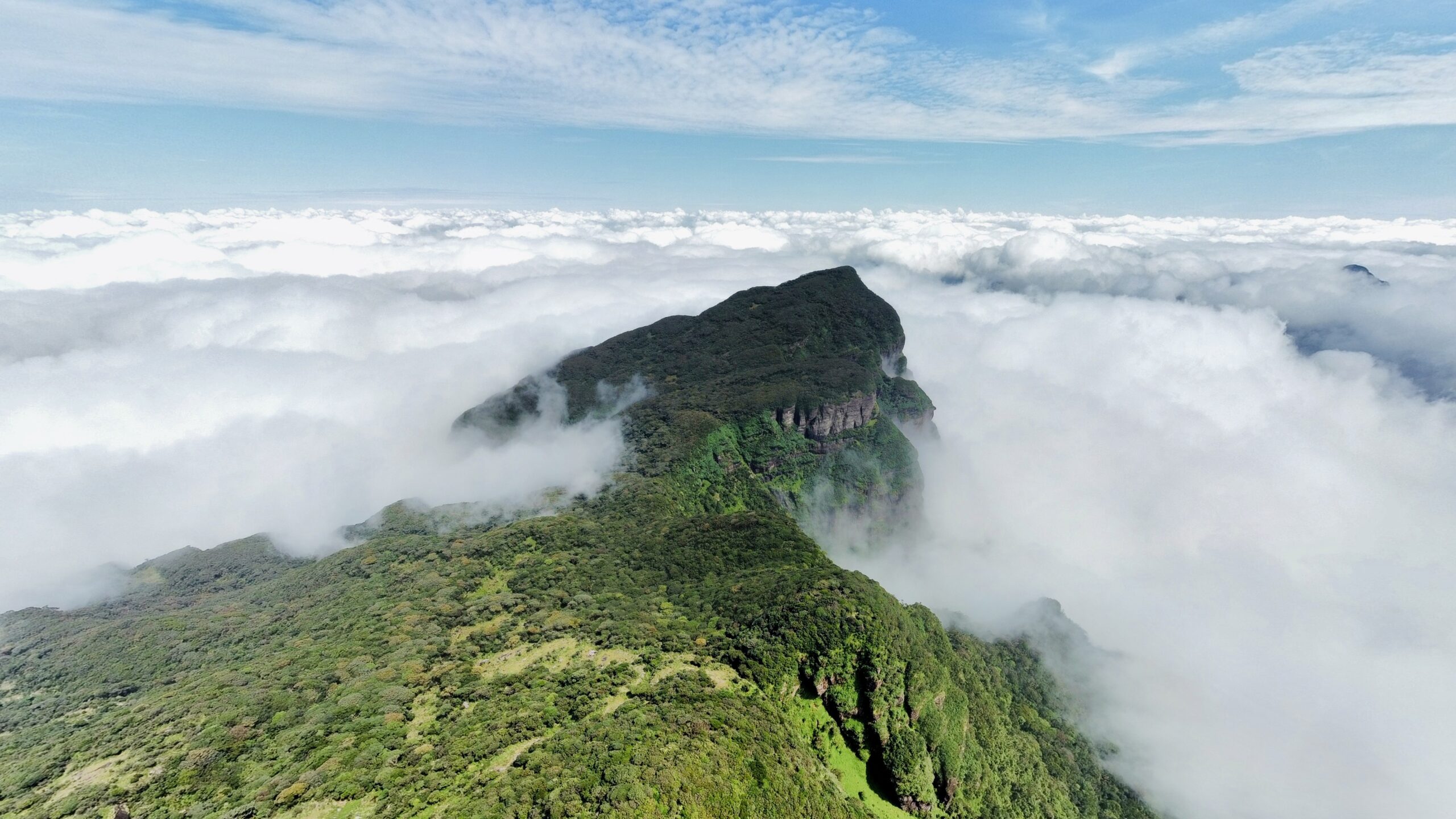
On the summit above the clouds
We carry on and meet the first hikers coming down, who tell us the top is close. Encouraged, we push over two small saddles and arrive on the summit.
Only up here do we finally break free of the dense growth, with wide views in every direction. And we get lucky: we’ve climbed above the cloud, which has flowed in from all sides. It’s a classic inversion—cloud about 100 metres below us, sun on our backs, and a well-earned rest on top.
After a while our solitude is broken by a couple arriving with a local guide. They’re from Belgium, and we chat. Leeches, they say, are a fact of life here—not just by streams but pretty much everywhere in the grass. The best protection is plain old Dettol: rub it on legs, clothing, and footwear. Their guide kindly treats our clothes and we instantly feel safer.
Although we’ve reached the end of the official trail, the Knuckles summit at 1,863 m is, according to the map, a little farther north. And sure enough, from where we stand a path runs along the ridge through a saddle to a neighbouring top. I’m a bit tired, but I set off to explore. The path here is less trodden, and the local guide warns me it’s not an official trail. A few minutes later I’ve made it across and I’m on the summit. It’s essentially the same elevation as the end of the official path, with very similar views. I can see why most people don’t bother.
The return
The weather is kind, so we linger on top, but the pull of a great dinner finally nudges us to retrace our steps. On the way down we pass a few more groups heading up. As usual, we’re the only ones without a guide. One guide escorting a Dutch group takes issue and gives us a brief lecture about how we shouldn’t be hiking unguided. It’s clear some local guides would rather people didn’t come here without them—lost business, and so on—though he couches it in other arguments. We listen politely and carry on. With the route now familiar, the descent is straightforward; before long we’re back at the tuk-tuk and then at our guesthouse. That dinner… but that’s another story.
Facts about the Knuckles Five Peaks hike
Location: Knuckles Conservation Forest, central Sri Lanka
Mountain range: Knuckles Mountain Range (Dumbara Kanduvetiya)
Highest point on the route: Knuckles summit – approximately 1,863 m a.s.l.
Elevation gain: approx. 500–600 vertical metres (depending on your starting point)
Distance: around 7–8 km (out and back)
Duration: typically 4–6 hours
Difficulty: moderate to fairly strenuous (physically), technically straightforward
Waymarking: minimal to none
Terrain: jungle, streams, muddy sections, grassy ridges, forest