


Our goal is to climb Mount Mangart in the Julian Alps—this time with our dog, Ibo. From the moment we arrived in Slovenia, the weather has been on our side: clear, stable, and with superb visibility. Exactly the kind of weather you hope for on a high‑mountain ascent.
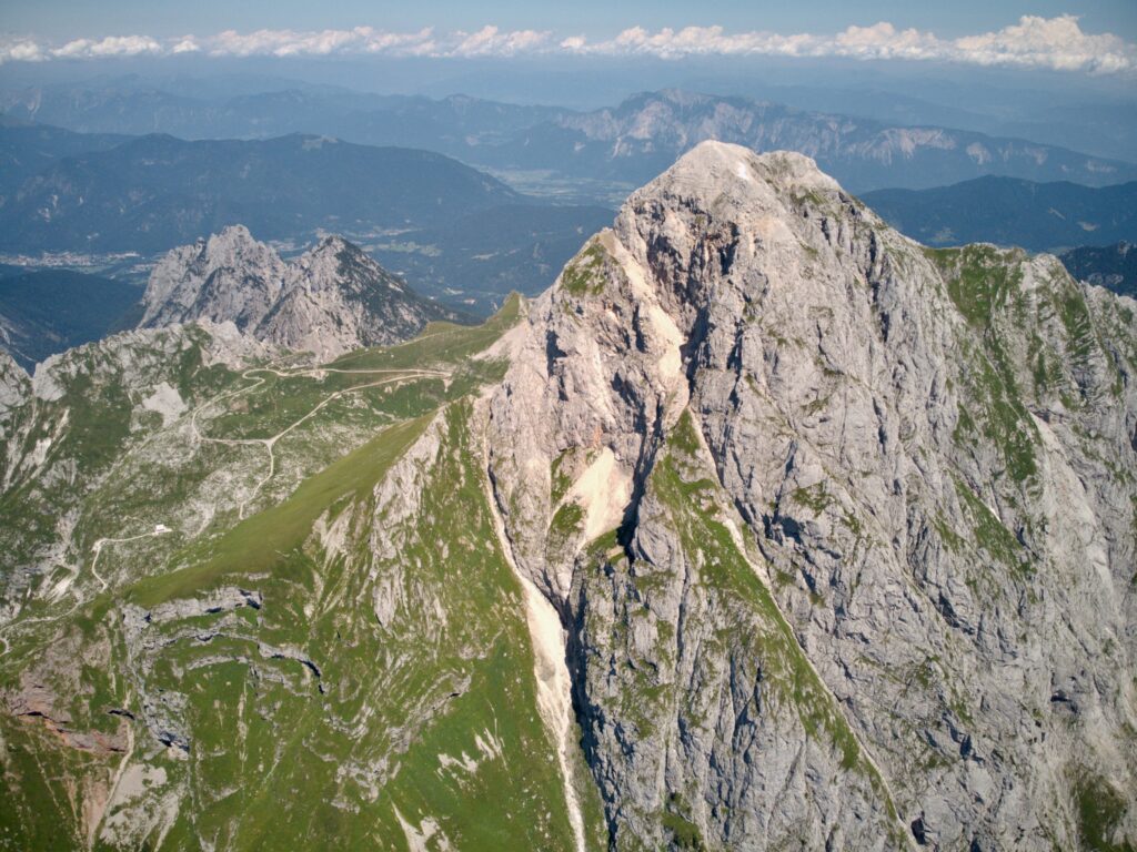
We first spot Mangart from the village of Log pod Mangartom, where we’re staying. The massive summit dominates the whole area, and even from afar it’s obvious the views will be worth getting up early.
Mangart Road
Log pod Mangartom sits just off the Mangart Road, so at first light we follow its narrow, winding bends to a car park at roughly 1,900 m a.s.l., a little below the Forcella della Lavina pass. We’d heard the road was damaged and you couldn’t drive all the way to the pass, and that proved true.
Two useful tips:
- Arrive before 7 am to avoid paying the access‑road toll of €10, collected right at the start.
- Before you go, check whether the road is open—early summer closures for snow on the tarmac are common.
The Mangart Road is an experience in itself. It’s the highest road in Slovenia, built in 1938. Expect countless hairpins, a few tunnels, narrow sections, and views that can feel uncomfortably exposed if you’re prone to vertigo—and all the more rewarding for it.
Climbing in ideal conditions
We set off from the car park mentioned above. The route follows the asphalt to the Forcella della Lavina pass at around 2,000 m a.s.l. From there, the trail starts out on an easy path that traces the border between Slovenia and Italy.
The path then splits. You can choose a tougher via ferrata on the Slovenian side of the massif or—like we did—the Italian normal route. There are still a few cable‑protected sections, mostly for trickier passages in bad weather. Apart from one more exposed section right at the start, the ascent is safe and well marked. As we’re here at the start of summer, a few snow patches linger, but they’re either easy to bypass or lie on relatively even ground.
With every metre we gain, the landscape opens up and the views keep building. On the Italian side, the Laghi di Fusine lakes steal the show. Far ahead we can also make out Slovenia’s highest peak—Triglav (2,864 m a.s.l.)—clearly recognisable.
Interested in this destination? Would you like to visit it with your dog? Check the entry requirements directly in BorderCooler®.
Mangart with a Dog
Opting for the Italian normal route proved a smart call. It’s the easiest line to the top and—barring a few small complications—doable with a dog. That was one reason we chose it, and neither we nor Ibo regretted it. Don’t forget the basics—not just for you, but for your dog too. We carried a longer hiking lead, a waist belt, plenty of water, and some treats.
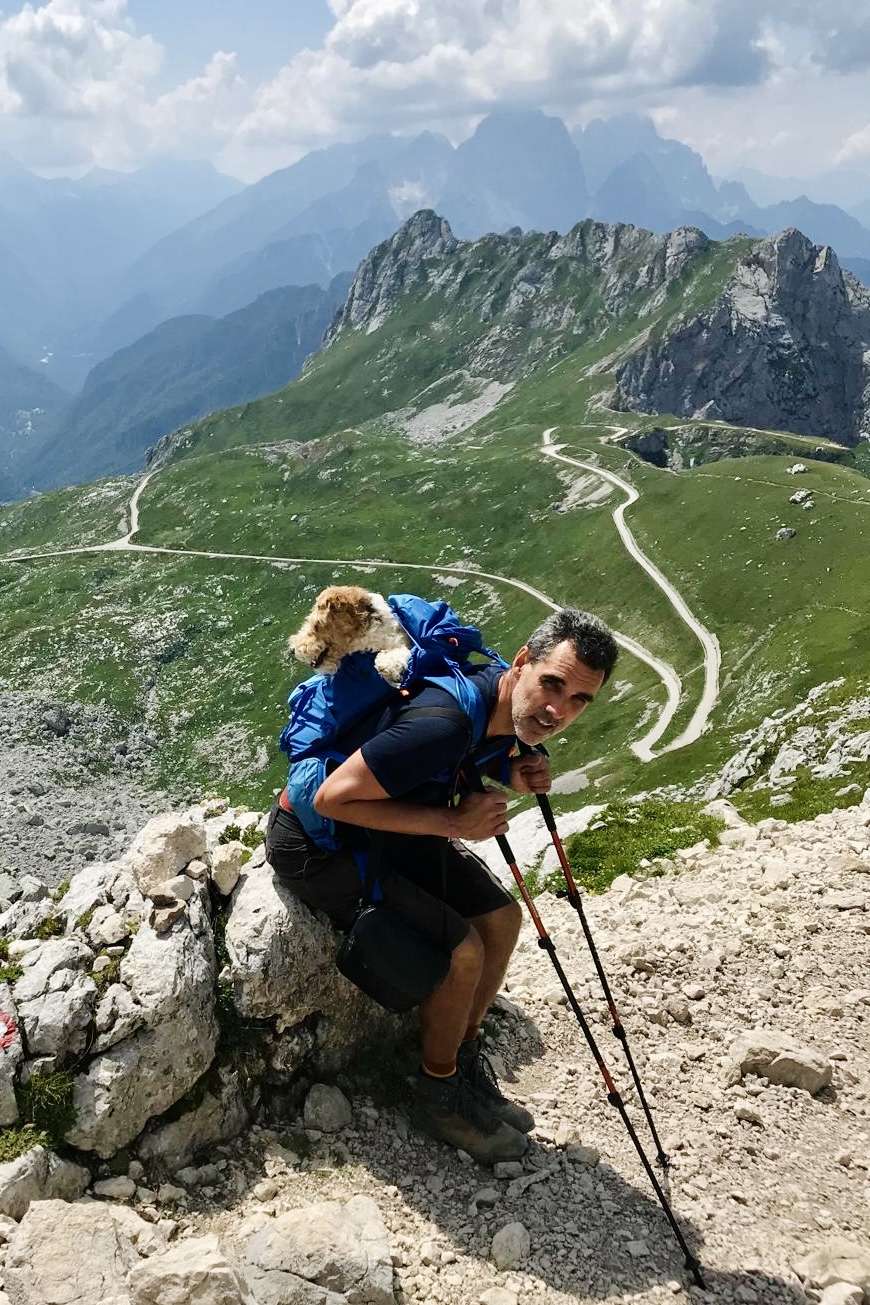
For much of the climb Ibo could follow freely, off‑leash. In riskier sections we put him on the lead. We only had to carry him twice, both over very short sections. In the end, the biggest issue for Ibo turned out to be the swarms of flies on Mangart’s summit, which we reached calmly and without any fuss, in perfect weather. From the top, the valley floors lay almost 2,000 metres below us in places, and the Julian Alps spread out in every direction.
We descended the same way, naturally at a brisker pace. Ibo, however, was even keener to hurry. To keep him from vanishing out of sight, I put him on the lead. That later meant that, in his effort to charge ahead, he scuffed his pads on the rocks.
To avoid further damage, I carried him in my backpack through the tougher sections of the descent. It sounds crazy, but I’ve dealt with this before. Iva took the contents of my pack, and Ibo went in. In the end I was the only one complaining—an extra 11 kilograms on your shoulders is something you feel straight away.
In the end everything worked out, and we managed both the ascent and the descent without any further issues. We reached the car with that satisfied feeling after a beautiful hike with sweeping views.
Fast facts about Mangart
Elevation: 2,679 m a.s.l.
Range: Julian Alps
Location: on the Slovenia–Italy border
Significance: the fourth-highest peak in Slovenia
Terrain: high‑mountain, rocky, exposed in places
Dog-friendly: feasible via the Italian normal route in good conditions
Best season: June–September (snow permitting)
Hazards: rapid weather changes, wind, early‑summer snowfields