


It’s early morning after an extremely short night spent stargazing, and we wake just below the summit of Cerro Paranal. We study the map from every angle, but the plan just won’t add up. From Cerro Paranal we’d hoped to make it all the way to Chile’s capital, Santiago. Unfortunately, we lost a few days at the very start sorting out the rental car. And those distances that look manageable on the map turn out to be far longer on the ground.
I pitch the idea of crossing San Francisco Pass back into Argentina. Ivana is immediately on board. Chile was great, if a bit pricey, but after a few days in this bone-dry corner of the world we genuinely miss seeing something green. An orchard, a tree, a meadow. The direction is clear now: Argentina.
San Francisco Pass sits at a lofty 4,726 m above sea level. Since we slept just below Cerro Paranal, around 2,400 m, we try to avoid dropping all the way back to the coast and then climbing again. It’s our way of minimizing the risk of altitude-related problems.
The only way to avoid the main highway that runs along the coast is to cut straight across the Atacama. That includes nearly 100 kilometers of unpaved road through an extremely remote slice of the Altiplano. It turns out to be the riskiest stretch of the whole trip. No signal, no people, no villages. We don’t see a single car. No streams, no lakes, no life. A breakdown would likely mean hours of walking in harsh conditions. It’s also worth noting that the day-night temperature swing here can be as much as 30 degrees. In the end, though, everything goes smoothly and we rejoin Route 5.
For stretches like this, fuel planning is critical. That applies not only in the Atacama, but also on Andean crossings. Gas stations pop up more often than you might think from the map, yet they’re still often hundreds of kilometers apart. At the time of our visit, fuel in Chile was a little more expensive than back home in Slovakia. In Argentina, it cost roughly half.
Our effort not to descend all the way to sea level is only a partial success. We don’t reach the ocean, but our route still drops into relatively low country, around 550 m. The real climb to San Francisco Pass begins in the small town of Diego de Almagro (790 m). It’s the shortest route on the map, but definitely not the most comfortable.
Information: the key to success
In town we ask about the road and whether it’s passable. An older man in a small shop kindly draws us a map, with a running commentary in fluent Spanish. It’s basically one long straight line with a single turn at the end, plus a big X that clearly warns us not to turn right. Buoyed by this “valuable” intel, we carry on.
Thanks to the omnipresent mining, the asphalt continues up to roughly 3,000 m. From there, road quality drops sharply while the altitude rises fast. Just before the steep climb we see exactly that right-hand turn the man crossed out for us. The X suddenly makes sense. The route we take is steep, but it still feels safe.
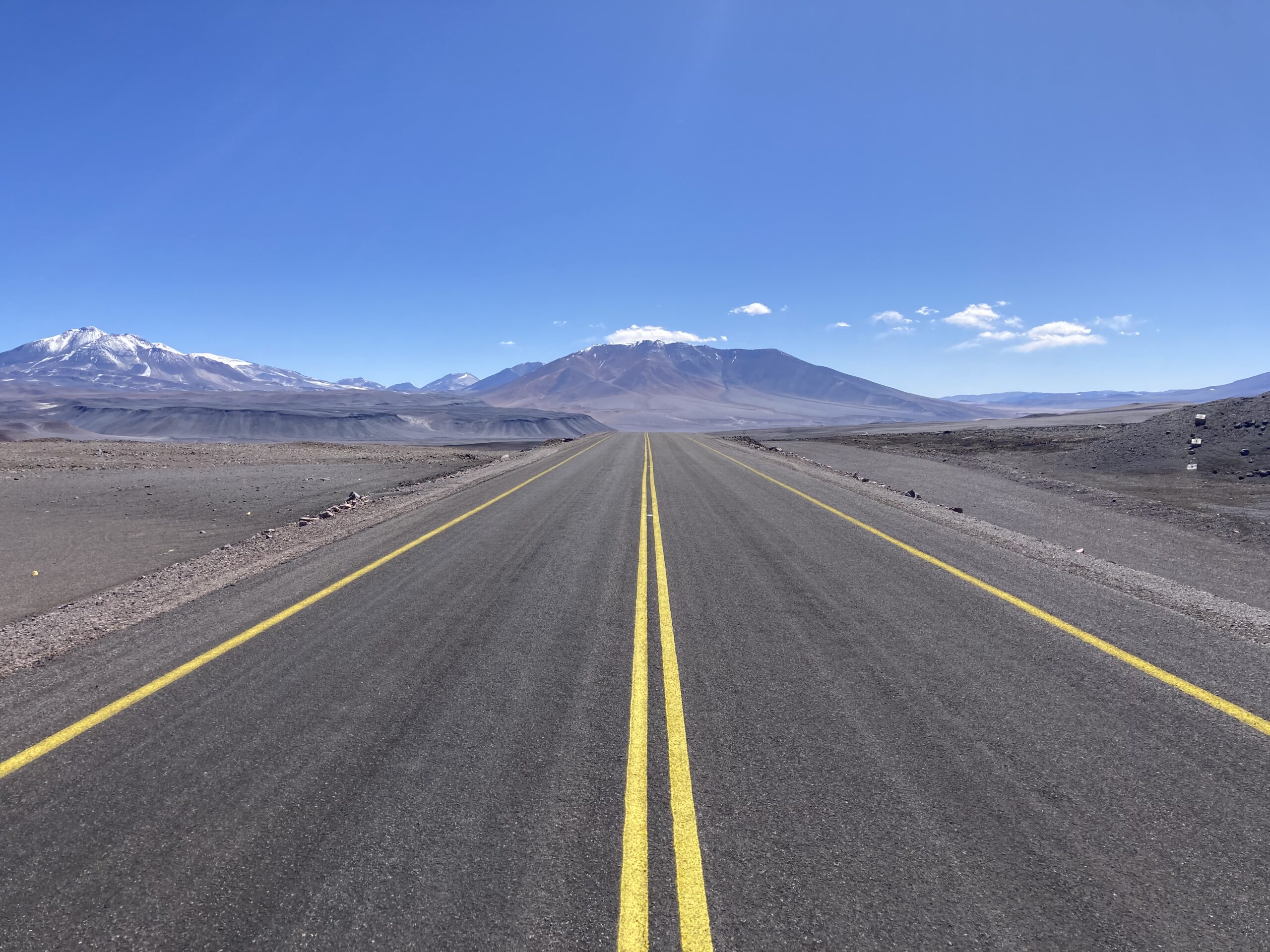
After a long grind through wildly twisting switchbacks, the road finally tops out onto a plateau near the Salar de Pedernales. Here it turns back to asphalt and leads toward Route 31, which runs to the Salar de Maricunga.
The border
The official border between Chile and Argentina lies right at San Francisco Pass, at 4,726 m. Understandably, few people want to work at that altitude, so the actual controls sit much lower down. As a result, the Chilean checkpoint is roughly 120 kilometers from the Argentine one.
We reach the first border hut on the Chilean side and get a surprise. There’s no customs officer, no police, no soldiers. The offices are open but empty, as if they’re being renovated. The only clue that you’re meant to stop is a thin chain stretched across the road.
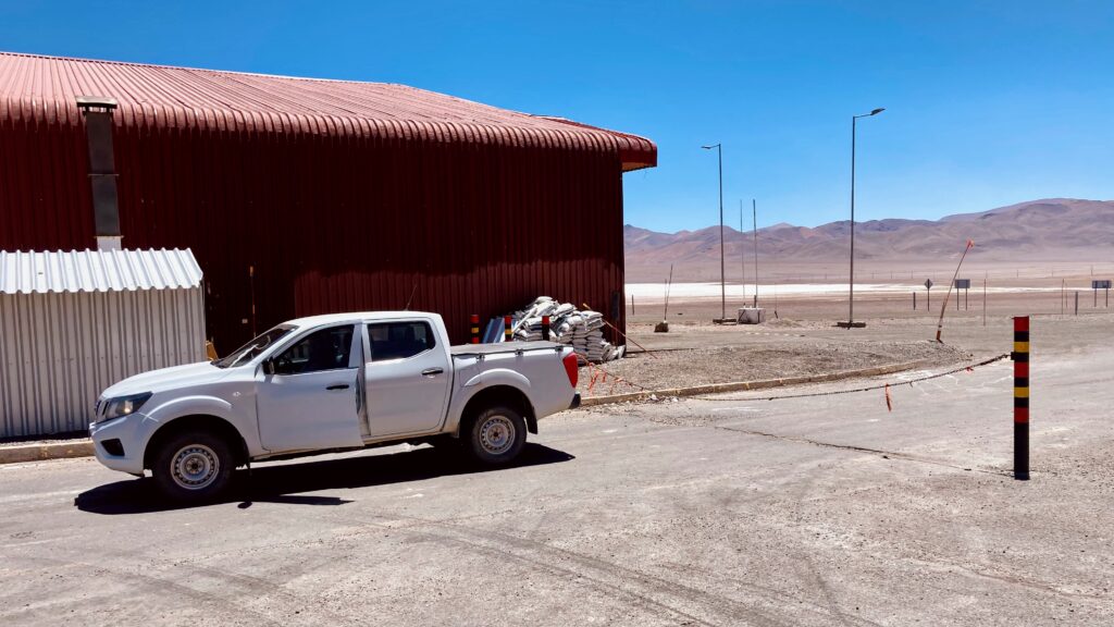
We stand around trying to figure out how this works. Meanwhile a truck pulls up. The driver gets out, drops the chain, gets back in, drives through, hooks the chain back up and continues toward Argentina. We figure that’s probably what’s expected of us too.
We look for someone to ask. We meet only three people: a construction worker who, with lots of hand-waving, indicates the border is closed, and two highway staff. In a jumble of Spanish, English, and gestures, they tell us to keep going. I hesitate, then lower the chain and we continue as well. Not exactly a typical border “control.”
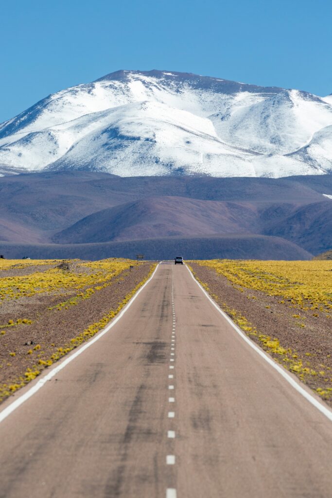
A few kilometers on, we reach the highest stretch of the road. The views are truly spectacular in every direction. We can’t help stopping several times to photograph landscapes that are entirely new to us.
Before crossing the border itself, we take a short break at Laguna Verde at 4,328 m. The water is extremely salty and an unbelievable shade of turquoise, a sharp contrast with the surrounding mountains.
Driving at these altitudes brings its own issues. A rapid ascent does all sorts of things to your body. A headache is just one symptom. Dry mouth, swollen sinuses, puffy feet, general fatigue, frequent urination, and getting winded by the simplest tasks are all common. Still, it was worth it.
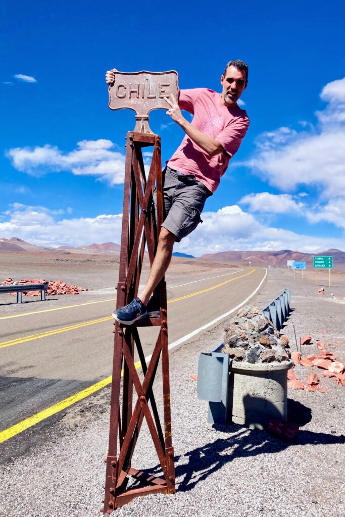
We reach the pass itself. We take photos by the border posts, gasp for air, get back in the car… and we’re out of breath again.
We drop into Argentina and the landscape slowly shifts. You can tell it actually rains here from time to time. The first hints of green appear, and we begin a steady descent.
Closed
Argentina’s border post may have one of the best views on earth, but that’s where our problems begin. From the first reactions, it’s clear something’s off. No one understands why we’re here. We learn the crossing is officially open only on Mondays and Thursdays. And we’ve shown up on a Wednesday. I mean… couldn’t you post that somewhere?
They simply won’t let us into Argentina. Besides bad timing, we’re missing Chilean exit formalities: no passport stamp, no record that our rental car left Chile. To make matters worse, no one here speaks English.
The situation starts to feel absurd. First, they ask us to return to Chile and cross “the proper way.” We refuse. We don’t have enough fuel, energy, or time to go back.
Option two is to sleep at the border and sort it out the next day. That’s tricky too — there’s nowhere suitable to sleep, and a night in the car would be bitterly cold.
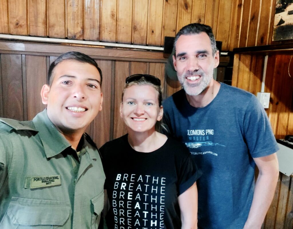
We negotiate hard and stay politely assertive. In the end, one employee — tasked with handling the day’s “odd cases” (us) — secures an exception. An older guard lifts the barrier and lets us into Argentina for one day, strictly to find a bed, on the condition that we return the next day to complete all the formalities.
We even have to promise we won’t “escape” into Argentina. We’re relieved… until we learn the nearest hotel is “only” 80 kilometers from the border.
Driving 80 kilometers three times isn’t appealing. We briefly consider the SOS shelters by the road — two benches and a stove. In the end comfort and fatigue win. We follow the officers’ advice and check into the recommended hotel. Warm, inexpensive, a great room, good food, and tasty Argentine wine.
Borderline absurdity
The next morning we’re split. I want to keep going, but Ivana insists we return to the border. For the sake of peace in the car, we turn back. Yesterday’s wine still hums in my head, boosted by the altitude.
We return to the border and start on the paperwork — thankfully without having to go back to Chile. They even search the car for contraband. At this point the absurdity peaks. We lose half a day, the officials are satisfied, and we collect stamps that are probably useless to us. But without this detour, some of our photos would never have happened.
From the border we head deep into Argentina’s interior and find a place to stay in the town of Famatina. Olives, jojoba, and walnuts are grown here. Suddenly there’s greenery and a river running — after days in the Atacama, a small shock, and exactly why we left Chile and said goodbye to the Andes for a while.
The very next morning the car won’t start. Diagnosis: dead battery. That’s when it fully hits us how lucky we were. If it had failed a day earlier, somewhere in the Andes or on the Altiplano…