


Another day on our Montenegro road trip. At first light in the village of Vusanje, I set off for the country’s highest peak — Zla Kolata. Iva isn’t feeling well today, so she stays at the hotel. It’s just me and our dog Ibo. I can already tell you he aced the hike… but I’m getting ahead of myself.
Zla Kolata sits in the Prokletije range, a place of serious mountains, a web of hiking trails and a raw, sometimes harsh landscape. It’s the kind of range where you quickly realise you don’t come to simply “have a look” — it demands respect.
By car, as high as possible
A long, demanding day awaits, under a fierce summer sun. I decide to coax the car as high as it will go. The track leaving the centre of the village turns from asphalt to dirt almost immediately and climbs gently through surrounding pastures. At around 1 250 m a.s.l. the road steepens and enters the forest.
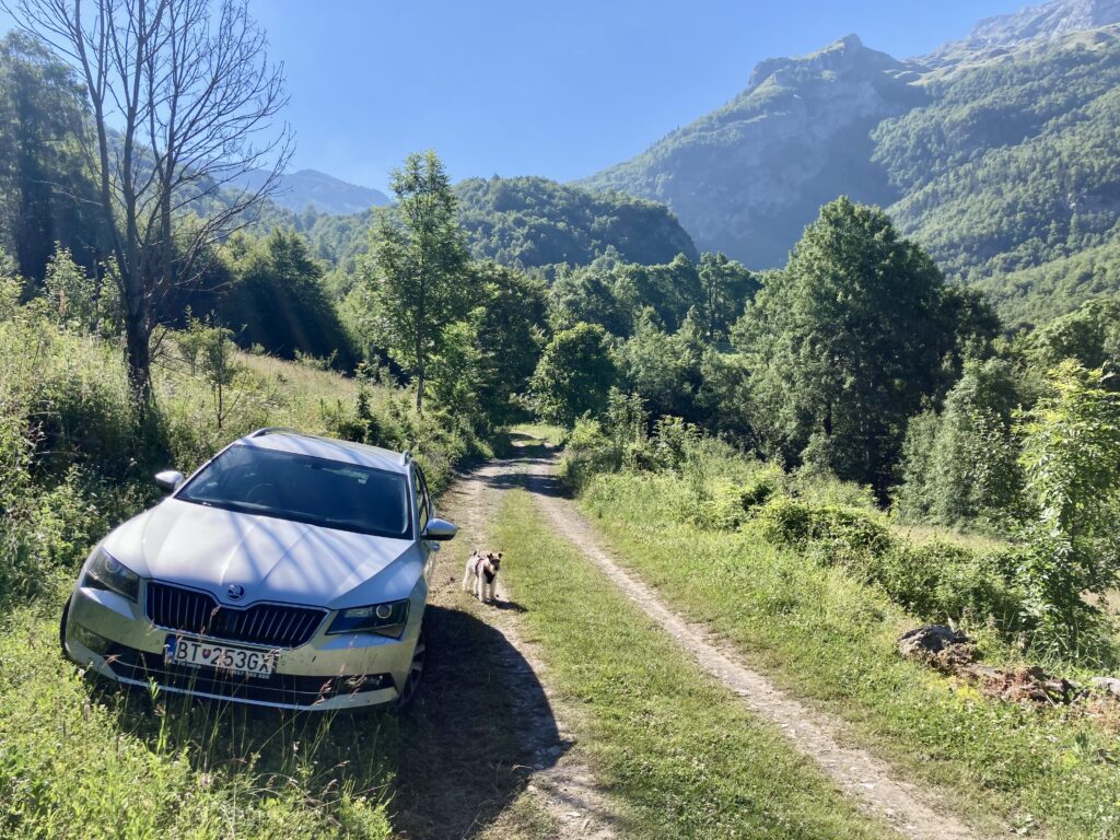
Here I run into a spot where a small stream crosses the track. The ground is muddy and, although the road beyond looks reasonable, I don’t fancy it in our Škoda Superb. From here on you’d want at least a standard SUV. We continue on foot. I did see cars parked higher up and never came across a no‑entry sign, so it’s fair to assume driving up is tolerated to a point.
Shepherd’s hut, sun, heat
After about an hour of climbing a steep dirt road we pass a small local shepherd’s hut on the right. A sign promises local products and even chilled beer. We don’t stop. Ibo isn’t big on beer and I’m keen to gain altitude as fast as possible before the sun melts us. It’s early, but you can already feel its rays heating the air around us.
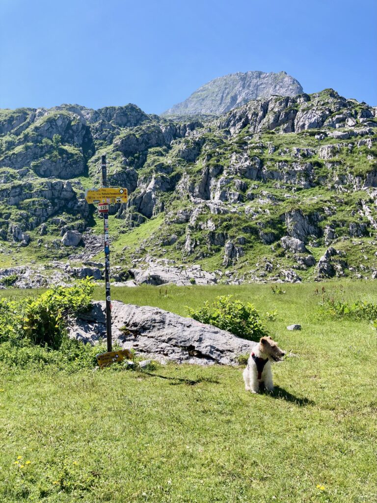
Just beyond the hut the path turns right, the gradient eases and the route weaves through low scrub and patches of uneven rock to a nearby clearing called Bora. The trail splits again here; we keep right. Waymarking is excellent — there are even signposts with destinations and time estimates that clearly point the way to Zla Kolata.
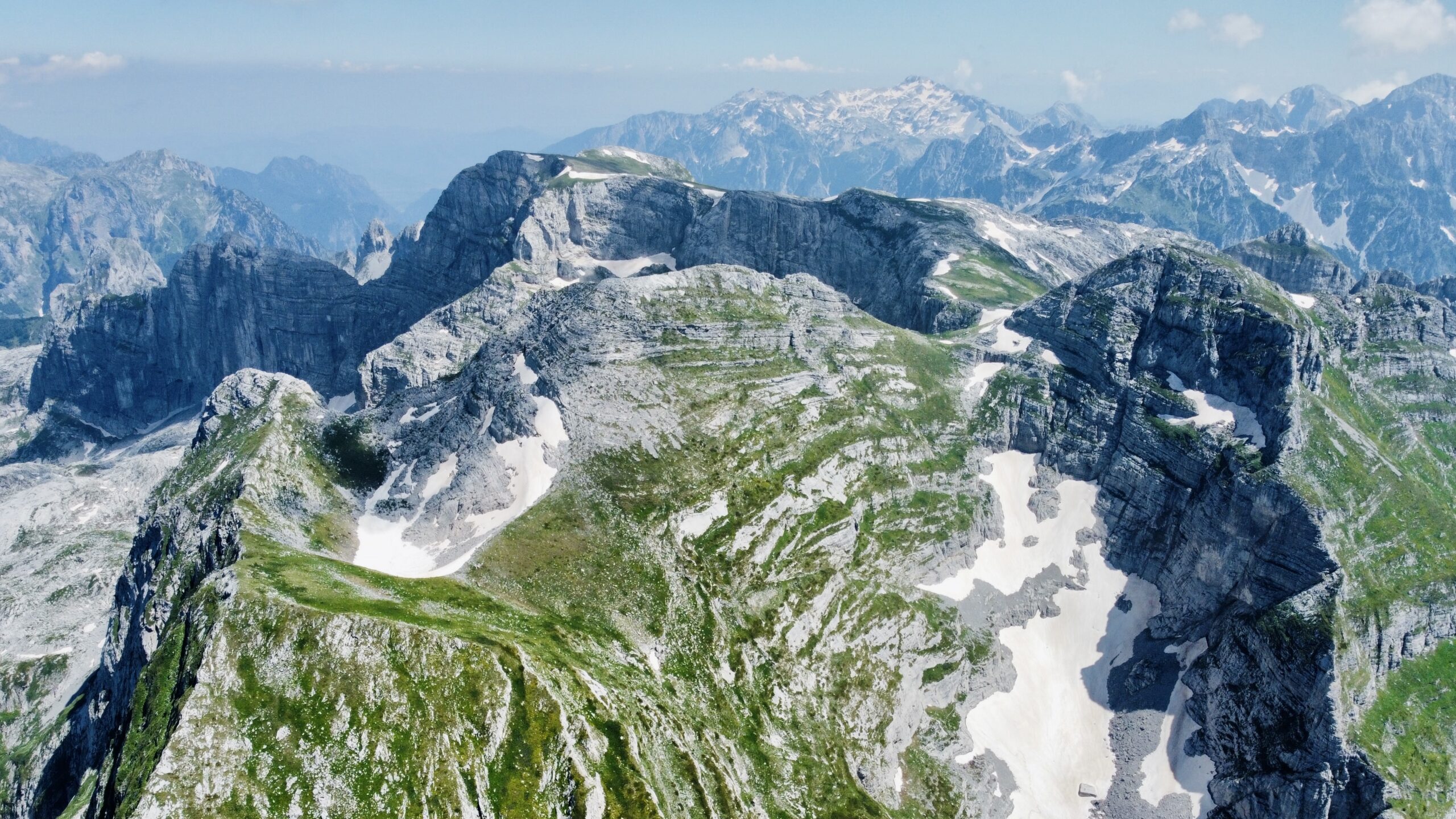
From the Bora clearing only a narrow path continues, climbing back into broken rocky ground. The slope is steep and hard to read from below — arguably the trickiest section to navigate. Once through, views open into the valley beneath Zla Kolata. You can see the Preslopit Pass (2 039 m) on the Albanian border, our first target, and the broad snowfield below the summit. I start suspecting the climb from the pass will throw up a few more challenges.
An unexpected cool‑down
Before we reach the pass we come to a cave called Ledena Pećina (Ice Cave) right beside the path. It’s easy to peek inside. A blast of icy air pours out — wonderfully refreshing on a hot summer day, and hard to walk away from.
At the Preslopit Pass we meet a fair few small hiking groups. Ibo and I are the only ones who’ve come up from the Montenegrin side. We take a short break and a quick snack. I weigh up whether to continue. We still have roughly 500 vertical metres ahead, and the view makes it clear the terrain will be tougher than so far. Curiosity wins. We’re making good time, so on we go.
Exposed terrain, snow, and carrying the dog like a bag
The route initially keeps to the right side of the cirque dropping from the summit, then quickly swings across to the left. It sensibly skirts the snowfield that blankets the bowl. We’re lucky — apart from a few short bits we avoid the snow entirely. We don’t have any winter kit with us, like crampons or an ice axe, so that’s a relief.
From there the trail continues over rock slabs and, in a steep climb, traverses above the snowfield. The ground is slightly exposed. In places I put Ibo on the lead. He seems to grasp the seriousness — he moves very calmly and stays close most of the time. As we gain height, we hit a few spots where I have to carry him. In those moments his hiking harness is priceless. I can grab it like a handle, lift him over, and set him down safely without too much bending.
The final metres
After a little adrenaline we reach the Prevoj Kolata pass between Dobra Kolata and Zla Kolata at roughly 2 400 m a.s.l. It’s a broad saddle, much of it still under snow. Fewer than 150 vertical metres remain, so up we go.
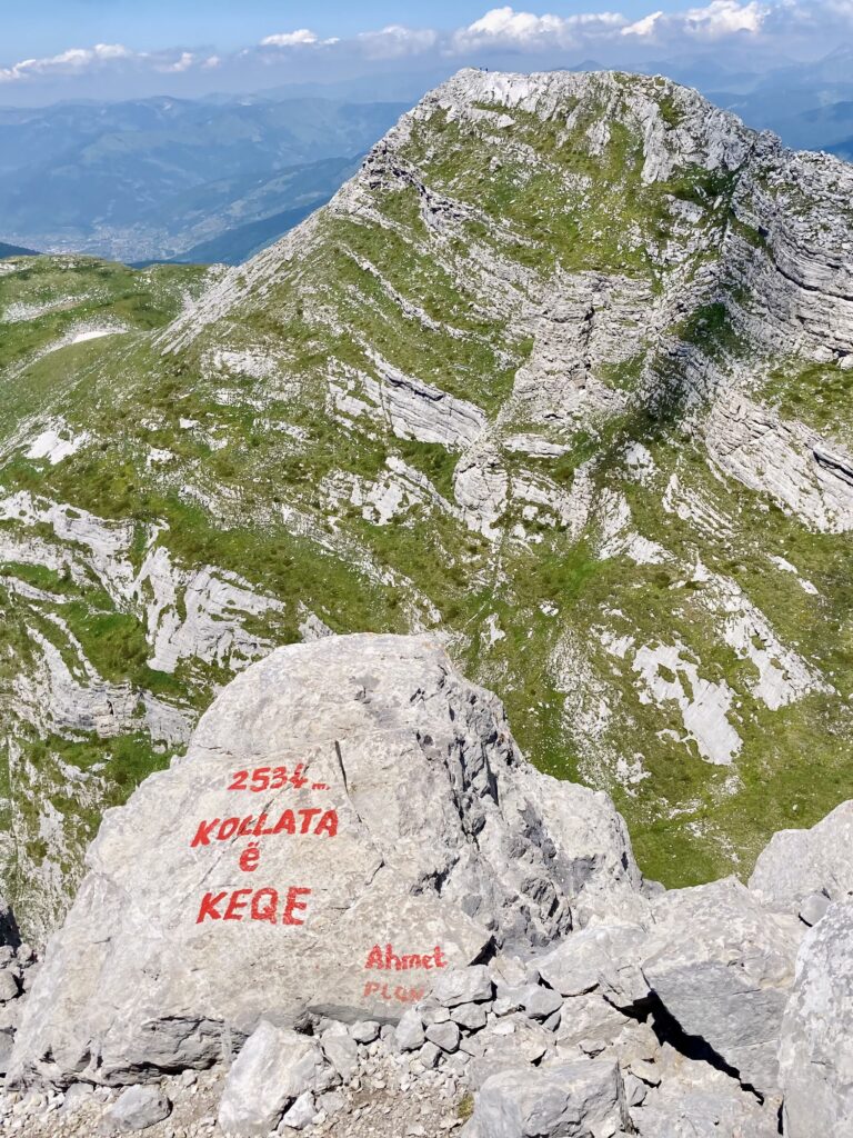
The last steps are tiring, but the reward is superb views. Ahead is Kolata e Mirë / Dobra Kolata (2 528 m a.s.l.) and Maja e Kollatës (2 556 m) over the border in Albania. In the distance, snow‑capped Albanian peaks; the landscape feels raw yet incredibly pristine.
I have the summit to myself — just me and the dog. We take a long break. Just before we leave a group of Croatian hikers arrives. We exchange a few words and then follow the same route back to the car. It’s glorious up here, but it’s time to move — there’s a long way back.
We tackle the trickier bit by the snowfield again, but from Preslopit we make brisk progress.
A reward at the end: Grlja
Instead of that chilled beer by the shepherd’s hut, I opt for the local Restoran Grlja on the edge of Vusanje. It’s a popular stop, but a good choice — quick service, a dog‑friendly attitude and big views all around.
The cherry on top is the nearby Vodopad Grlja waterfall. If you decide to visit, keep your dog on a lead. A fall into the waterfall would almost certainly be fatal.
With that post‑hike glow — and full stomachs — we get back in the car and head for our base in the little town of Andrijevica. What a day we’ve had!
Facts about Zla Kolata and the ascent
- Summit: Zla Kolata
- Elevation: 2 534 m a.s.l. (Montenegro’s highest point)
- Range: Prokletije
- Starting point: the village of Vusanje
- Total ascent: approx. 1 500 – 1 600 m (depending on where you park)
- Distance: approx. 14 – 16 km (out and back)
- Time: 6 – 8 hours (without long breaks)
- Difficulty: demanding mountain hike, sections of exposed terrain; with a dog only if fit and experienced