


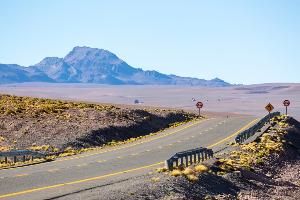
After a relaxed, fascinating morning on Salinas Grandes, we continue west. About 350 kilometers of completely unknown country lie ahead. On the map it looks straightforward—a winding line from Argentina into Chile, all the way to San Pedro de Atacama. Still, we have a feeling the reality will be far more varied.
The only thing we truly know is that we’ll spend the whole day at altitude, in an extremely dry land with barely any infrastructure. No cities, just the odd settlement, long stretches without signal, and landscapes that favor the prepared. We’re full of questions, but also a mix of curiosity and respect—the kind of tension that comes with travel.
All sources say the road is paved the whole way. And even if it weren’t, we’re ready. In Salta we’ve rented a Nissan Frontier pickup that feels less like a luxury here and more like sensible insurance. The truck is packed, water topped up, and we hit the road.
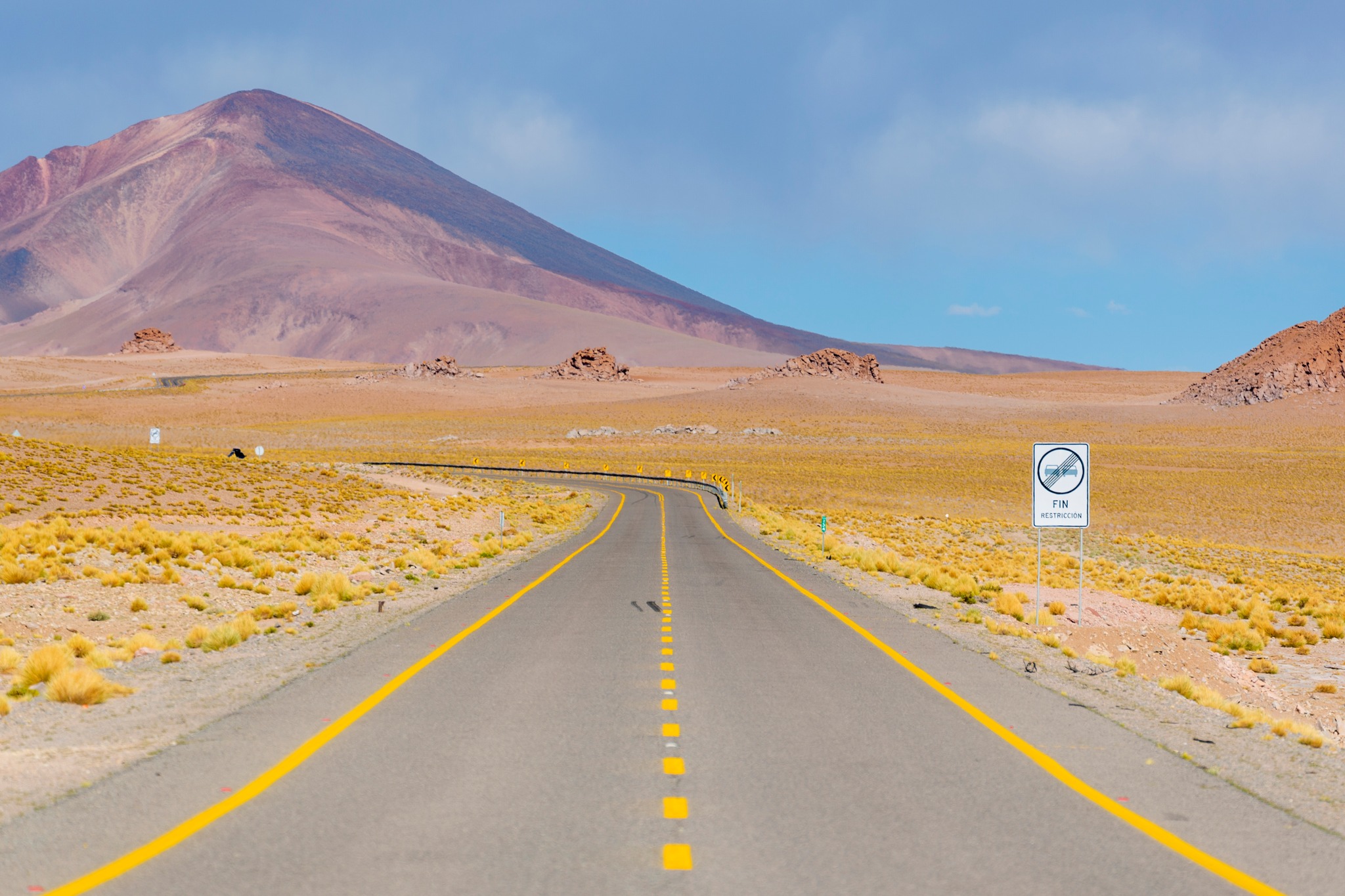
The landscape around us
We slowly settle into the feel of this region. Hills rise on all sides above an already high road. It winds and climbs gently from roughly 3,500 m a.s.l. to about 3,800 m a.s.l. After around an hour we pull into the village of Susques.
According to the map there should be a gas station here, and because we like to keep a healthy reserve, we go looking for it. We eventually find it at the far end of the village, high on a hill. We fill the tank and, with hunger creeping in, start hunting for a place to eat.
A restaurant at the end of the world
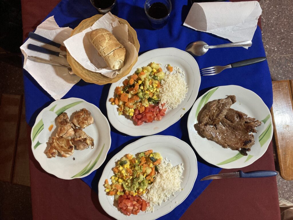
Susques is a tiny, quintessential Andean village, so finding a restaurant doesn’t take long—there are only a few streets. We end up in an unassuming place as the only guests, looked after by the señora of the house, who seems as surprised to see us as we are to find ourselves here. With a mix of words and gestures we order the one dish she can make today: a plate of grilled meat with a side and salad. We’ll have a few more encounters like this before we understand that such a meal is actually a cut above here—and worth appreciating. It costs next to nothing, which we barely even discuss. The Wi‑Fi and the spotless bathrooms are a lovely surprise. We came in uncertain; we leave well fed and in good spirits.
On our way out we catch a striking scene: dozens of locals standing by the main road, watching a football match on the village pitch. Rested, with a full tank and, crucially, full stomachs, we say goodbye to Susques and carry on.
Onwards to the border
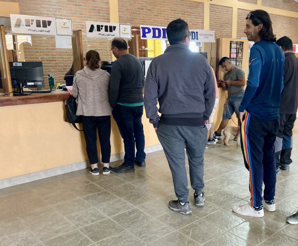
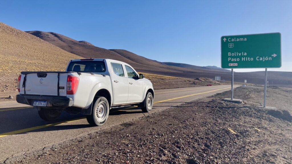
From here it’s still over 100 kilometers to the Chile–Argentina border. The road keeps climbing—slowly but surely—to around 4,250 m a.s.l. A little over an hour later we reach Jama, the last Argentine village, where the border post sits on the far edge of town. The process works a bit differently than you might expect. You park the car, get out, and take your documents into a nearby building where both controls—Argentine and Chilean—operate side by side. They scrutinize all travel papers: passports and, in my case, a Paraguayan resident card (cédula). Then come the car documents. The rental agency has equipped us with the necessary paperwork, which the officer stamps here. There’s also an inspection of the vehicle and luggage. By local rules, a number of specific food items aren’t allowed across. We do have some supplies in the car, but in the end it isn’t an issue. After roughly thirty minutes of checks we’re cleared to continue.
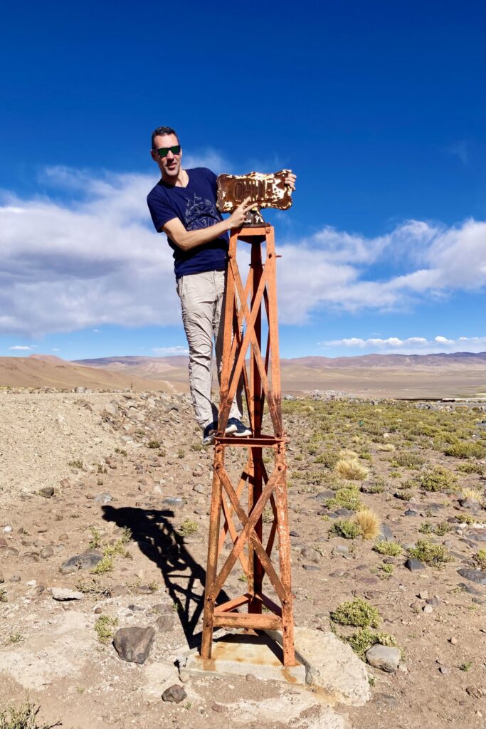
The actual border lies just beyond the checkpoint, modestly marked—we drive past without even noticing. Since I really want a photo at the border, I quickly turn around and we return to the spot where the imaginary line splits the two countries. There’s a small pull‑off and, instead of a stone marker, a typical metal frame with a plaque: Argentina on one side, Chile on the other. After the photos and a short break we set off on the final leg to San Pedro de Atacama.
Where dreams are born
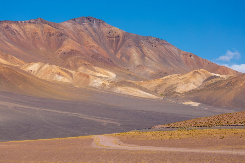
This last section brings the biggest surprises. First, I’d assumed the road would descend from the border. Not so. The climb continues for quite a while, topping out at an impressive 4,831 m a.s.l. on the Chilean side. Then the landscape shifts. While the Argentine side felt rather monotone—desert‑dry and stark—the Chilean side feels more colorful. The stretches around the lagoons are especially captivating: mirror‑bright water flecked with flamingos, and in the background the painted slopes of Altiplano peaks—views that etch themselves in quickly.
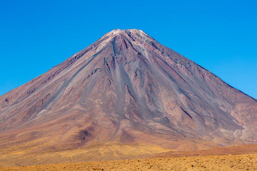
The most striking moment comes just a few kilometers before our destination. We pass the turn‑off to the Atacama Large Millimeter Array without a second thought (we had no idea it was even there at the time), and soon pull up at the junction toward Bolivia. The Chile–Bolivia border is literally just up the road, and if the sun weren’t sinking, we’d have gone for a look. In the end we decide it’s wiser to reach San Pedro de Atacama before dark. What truly steals the show, though, is the massive, pyramid‑shaped volcano to our right—the unmistakable landmark of this region. A peak whose name we don’t yet know stands like an icon from an encyclopedia. Nothing draws the eye more than this silent triangle. The sight hits me so hard that at the first chance I check the map: it’s Licancabur.
And so, on the day we first crossed the Andes from one side to the other, a new dream was born too—to one day climb that very volcano that so dominated the end of our journey.
All that remained that day was an almost endless descent from the plateau down to San Pedro de Atacama. Brimming with impressions from an unforgettable drive, we check into a local hotel before dark and collapse into bed.
Paso de Jama: key facts
- Name: Paso de Jama
- Location: a border crossing between Argentina and Chile
- Highest point: around 4,831 m a.s.l. (on the Chilean side)
- Connects: northwest Argentina (Jujuy Province) with the San Pedro de Atacama area in Chile
- Road type: paved, generally open year‑round (weather permitting)
- Landscape: high‑altitude Altiplano, desert environment, lagoons and salt flats
- Highlights nearby: flamingo‑filled lagoons, Licancabur volcano, the Atacama Large Millimeter Array (ALMA) research facility
Paso de Jama ranks among the highest and most scenic road crossings in the Andes and serves as a key gateway between Argentina and the Atacama Desert.