


During our time in Ecuador we packed in a bit of everything—travel days, waterfalls, beaches, short outings, and plenty of local culture. But a proper mountain trek kept slipping through our fingers. So the day before our flight home, we set ourselves a goal: climb at least one local volcano.
Naturally we pick something straightforward, with no technical sections or complicated logistics. Enter Pasochoa—an extinct volcano not far from Quito. Online guides tout it as a popular choice for acclimatizing before bigger, higher climbs. Sounds appealing. Almost the perfect warm‑up. A piece of cake.
Soon enough, we learn that reality is often a touch more colorful than the terse lines in guidebooks.
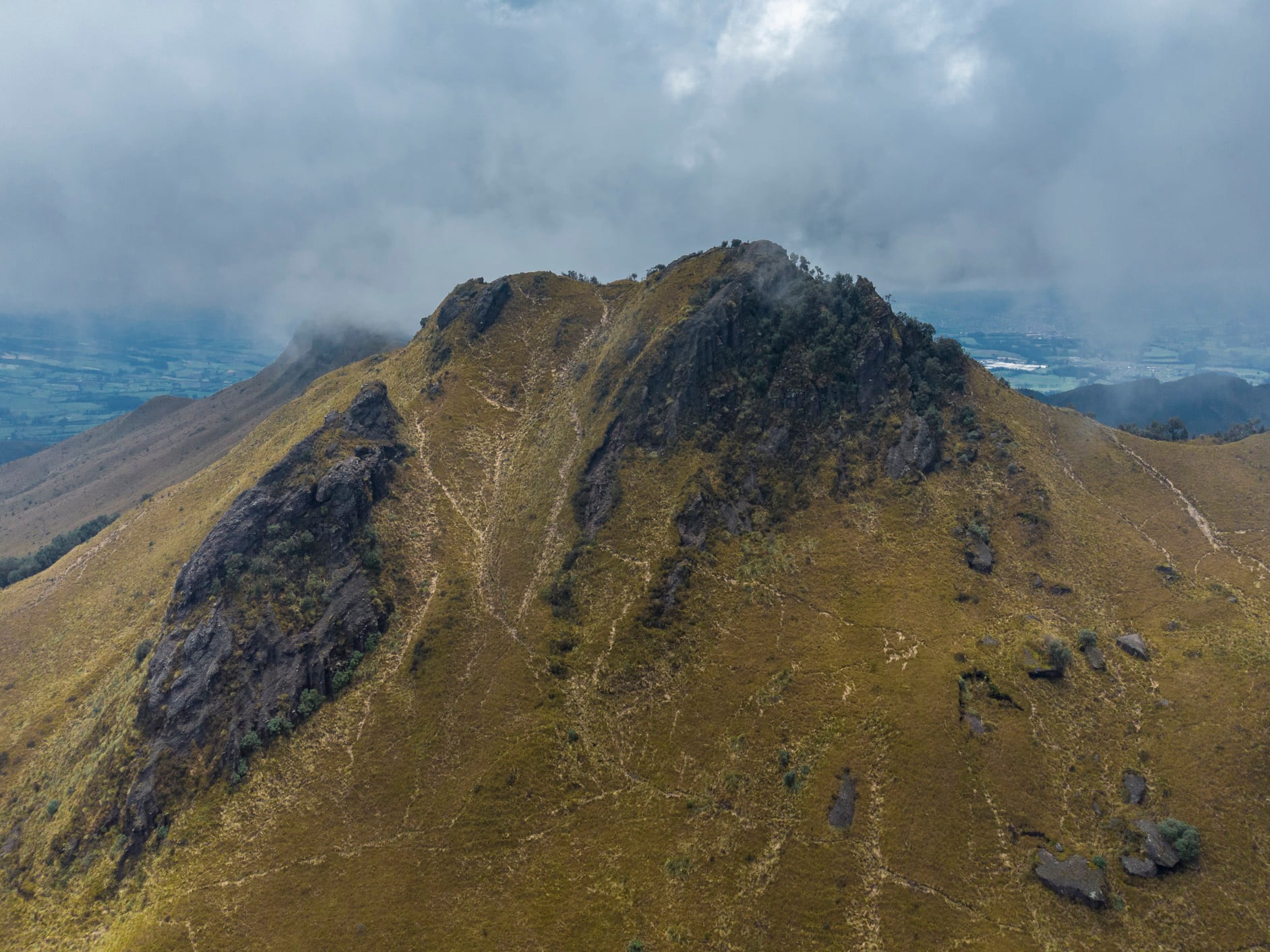
Pasochoa volcano
Pasochoa rises to about 4,200 m a.s.l. and sits within a protected area best known for its exceptional vegetation. Its slopes blend montane cloud forest, dense Andean jungle, grasslands, and the high‑altitude páramo. That mix makes the climb varied and engaging from the very first steps.
Early start
We set off early and drive to the Secret Garden Cotopaxi camp to park. Not quite sure how parking works here, we leave the car on the roadside outside the property. Our only company: the resident llamas.
It takes us a bit to find the right trailhead. After about twenty minutes of wandering we finally join the correct route. Our altimeter reads 3,450 m a.s.l., and the climb can begin.
Thick jungle and a brisk climb
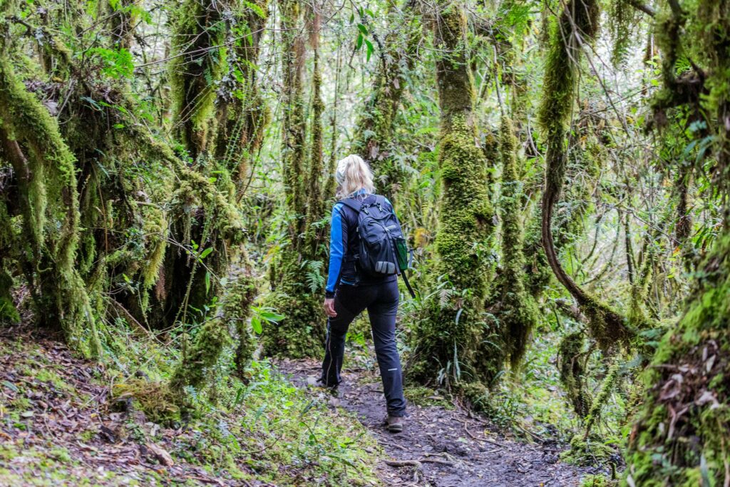
The first stretch pushes through genuinely thick jungle. The path is narrow and climbs at a brisk angle. The air barely moves and the humidity packs a punch. It isn’t especially hot, yet we’re sweating within minutes.
After about an hour the trail emerges from the jungle into more open, grassy slopes. Off to our right the views open toward the opposite side of the valley and a small waterfall. It’s the dry season, so instead of a torrent it’s a delicate ribbon of water sliding down the rock.
A gentler stretch and the first encounters
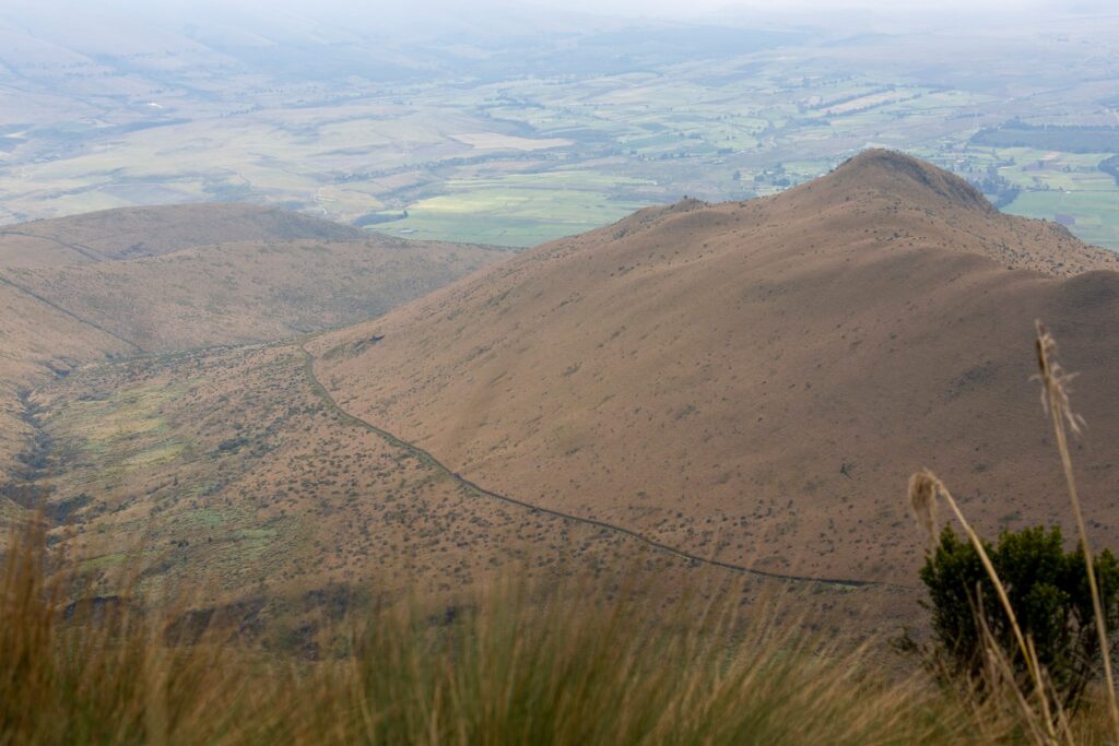
Another half hour on, the path meets a wider track, likely once drivable. This section leads almost all the way to the saddle on the main ridge. Compared to the start it’s far more comfortable, and the open terrain finally lets a light breeze dry us out.
The track carries us up to roughly 3,850 m a.s.l., where it ends and a narrower, steeper path peels off toward the ridge. Here we meet the first people already heading down from the summit—everyone we pass clearly started much earlier than we did.
Feeling the altitude
Up here we start to feel how much vertical we’ve already gained. Progress demands more frequent pauses. Where the path gains the ridge, we take a longer break, hoping the rest of the way will ease up.
Not quite. We’re around 4,000 m a.s.l., and we’ve barely paid attention to acclimatization in the days before. That oversight comes due. The breaks get ever more frequent, and morale doesn’t improve as more groups file past us on their way down.
We keep debating whether to push on or turn back. In the end, ego wins and we carry on. A few clouds build, but the wind keeps sweeping them off, so the weather stays in our favor.
The final push
The last meters are brutal. We’re stopping every thirty meters, and even with the goal in sight, every step is a slog.
We pretty much crawled our way up—but we make it, and we’re standing on the summit. We linger for a while: the views are lovely, the place earns a few drone shots, and, most importantly, we give ourselves a proper rest.
The way back
After a while we say goodbye to the summit and follow the same trail down. The descent is smooth and far more pleasant than the climb—breaks are barely needed. We reach the car earlier than expected.
Despite our doubts on the way up, the hike comes together in the end. We didn’t just laze our way through Ecuador—we’ve got at least one honest volcano ascent to show for it. And while Pasochoa is an unassuming peak in a country of far bigger summits, for us it’s a vivid, memorable day out.
Key facts about the Pasochoa hike and volcano
- Type: extinct volcano
- Location: south of Quito, Ecuador
- Summit elevation: approx. 4,200 m a.s.l.
- Trailhead elevation: approx. 3,450 m a.s.l.
- Elevation gain: about 750 m
- Ascent time: 3–4 hours (depending on pace and acclimatization)
- Descent time: 2–3 hours
- Difficulty: moderately strenuous (due to altitude)
- Technical difficulty: low
- Terrain: jungle, cloud forest, grasslands, páramo
- Good for: acclimatization before higher climbs