


After several days traveling through Norway, we deliberately stepped away from the busy tourist spots. We wanted quiet, fewer people, and more nature. We found exactly that at Lake Birtevatn, tucked into the Setesdalsheiene mountains.
It’s a very picturesque area — the lake is ringed by mountains, dense forests, and smaller tarns. We reached it via well-maintained gravel roads 3384 and 3386, which climb through beautiful woodland from the town of Fyresdal on the shore of the well-known Lake Fyresvatnet.
Quiet cabin country, well away from the crowds
The whole area is known as a favourite cabin getaway for locals. You’ll find plenty of small and larger weekend cabins, yet nothing feels crowded or intrusive. Buildings are scattered over a wide area, and their architecture blends naturally into the landscape.
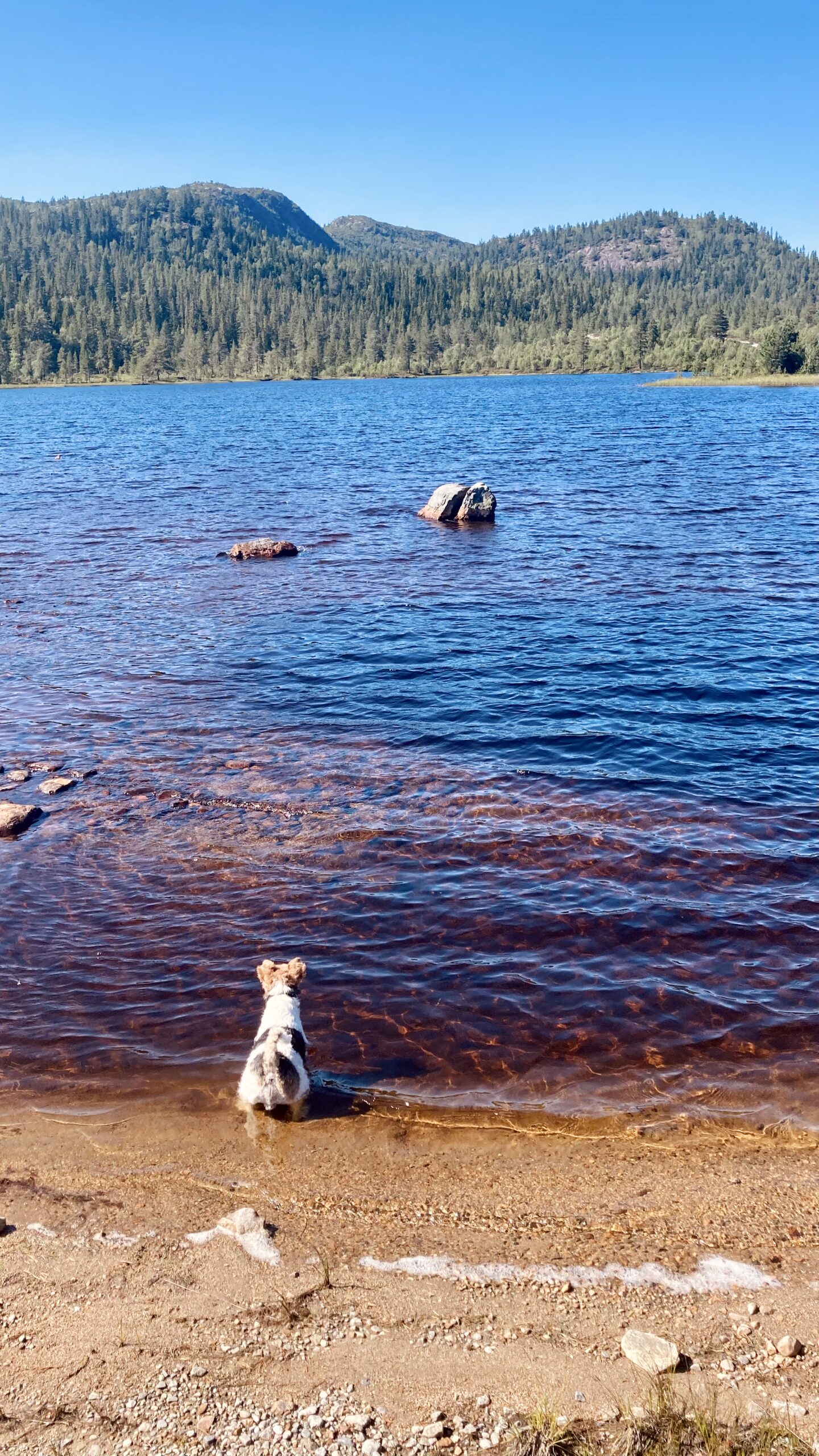
From a hiking perspective, the region is wonderfully varied — from short strolls to full-day outings. You can swim in the nearby lakes without any trouble, which is a great summer treat, even though the water was only about 15 °C. The whole landscape radiated a calm and quiet we loved.
Ascent of Kviptefjell
Our main goal was the nearby Kviptefjell (903 m a.s.l.). The trail starts at a parking area on Kviptevegen, right where a barrier blocks further driving. There’s a phone number on it, but no one answered — no matter; the trailhead is only about 420 metres from there.
We lace up our boots, pack supplies for us and for Ibo, and set off. After a short stretch on the road we turn sharply right onto a narrow forest path. At times it crosses small meadows and boggy patches, so expect slightly soggy ground. The higher we climb, though, the drier and more pleasant the terrain becomes.
After gaining roughly 150 metres of elevation, we leave the forest belt. Views open up across the landscape, and it’s clear the local lakes form a broad water system channeling runoff from the highest reaches of Setesdalsheiene. The trail swings left and climbs onto an open ridge. This is about the steepest section, but the slope soon eases and the whole ridge unfolds in front of us.
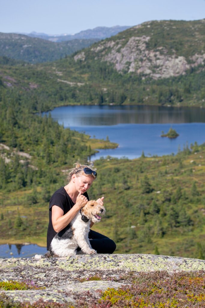
At an easy pace we reach the summit of Kviptefjell. The joy at the top was all the greater because we had it to ourselves. No crowds — just wind, silence, and wide-open views of Norwegian wilderness at around 900 m a.s.l.
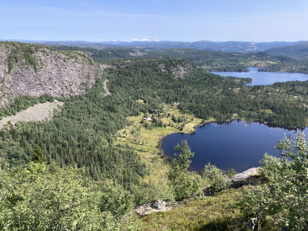
The route continues along the ridge, which curves above Lake Kviptetjønn. It gradually drops to a shallow saddle, from where it’s only a short detour to Lake Blakstjønn. We couldn’t resist and headed for the water. I went for a swim, and so did Ibo.
The return leads through forest back to Kviptevegen. The route draws close again to Lake Kviptetjønn, which we had on our left most of the time. The final metres before rejoining the road are boggy in places, but wooden boardwalks over the wetlands make progress much easier. In the end we make it back to the car relaxed and full of good memories.
Final thoughts
The ascent itself isn’t technically demanding. It’s an easy ridge hike across straightforward terrain. The full loop takes about 4 hours and is ideal for a medium or large dog. As the route is technically simple, no special gear is needed — for you or for your dog.
Key facts about the hike
- Summit: Kviptefjell (903 m a.s.l.)
- Range: Setesdalsheiene
- Location: Fyresdal area, southern Norway
- Route type: loop / ridge hike
- Time: approx. 4 hours
- Difficulty: easy
- Terrain: forest paths, meadows, bogs, open ridge
- Dog-friendly: yes (medium and large dogs)
- Best season: late spring – summer – autumn