


I picked most of the stops on our Norway road trip, but Iva also got to shape the plan. One of her additions was Leka Island. Honestly, we’d never even heard of it. So it was all the more surprising to learn it’s not just another unassuming island, but a place that’s remarkable by global geological standards.
Even the ferry is a surprise
Leka Island sits off the coast of central Norway, north of Namsos, in Trøndelag. It covers roughly 57 km² and has about 580 residents. On the map it looks unassuming, but its terrain tells a very different story.
We set out for the island after a night at Haran campsite by the E6. Morning greets us with rain and wind again—the kind of weather we’ve grown used to on this Norway trip.
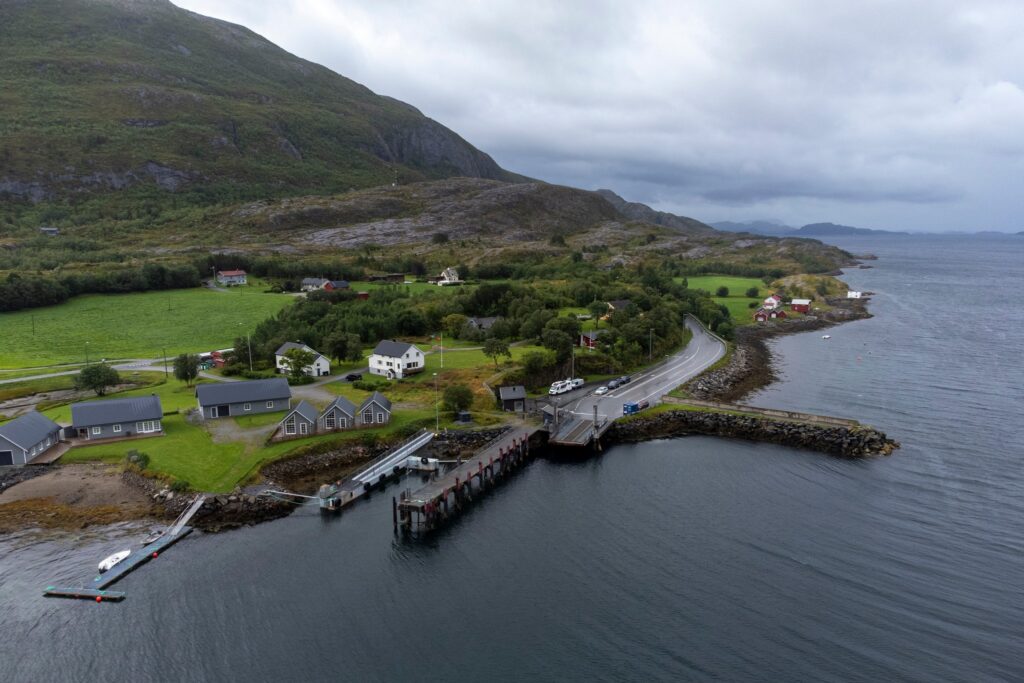
The ferry to Leka runs from the little harbour village of Sør-Gutvika (Gutvik) and it’s free. You can wait in your car or in the small harbour building.
That building surprised us most. The waiting room is heated, with Wi‑Fi, drinking water, power outlets and a toilet. There are a few tables and chairs, magazines, and a lovely view of the bay. It’s Norway in a nutshell—quality services and infrastructure showing up even where you least expect them.
The crossing takes only a few minutes, yet the ferry is comfortable, offers refreshments, and barrier‑free access is a given.
First impressions
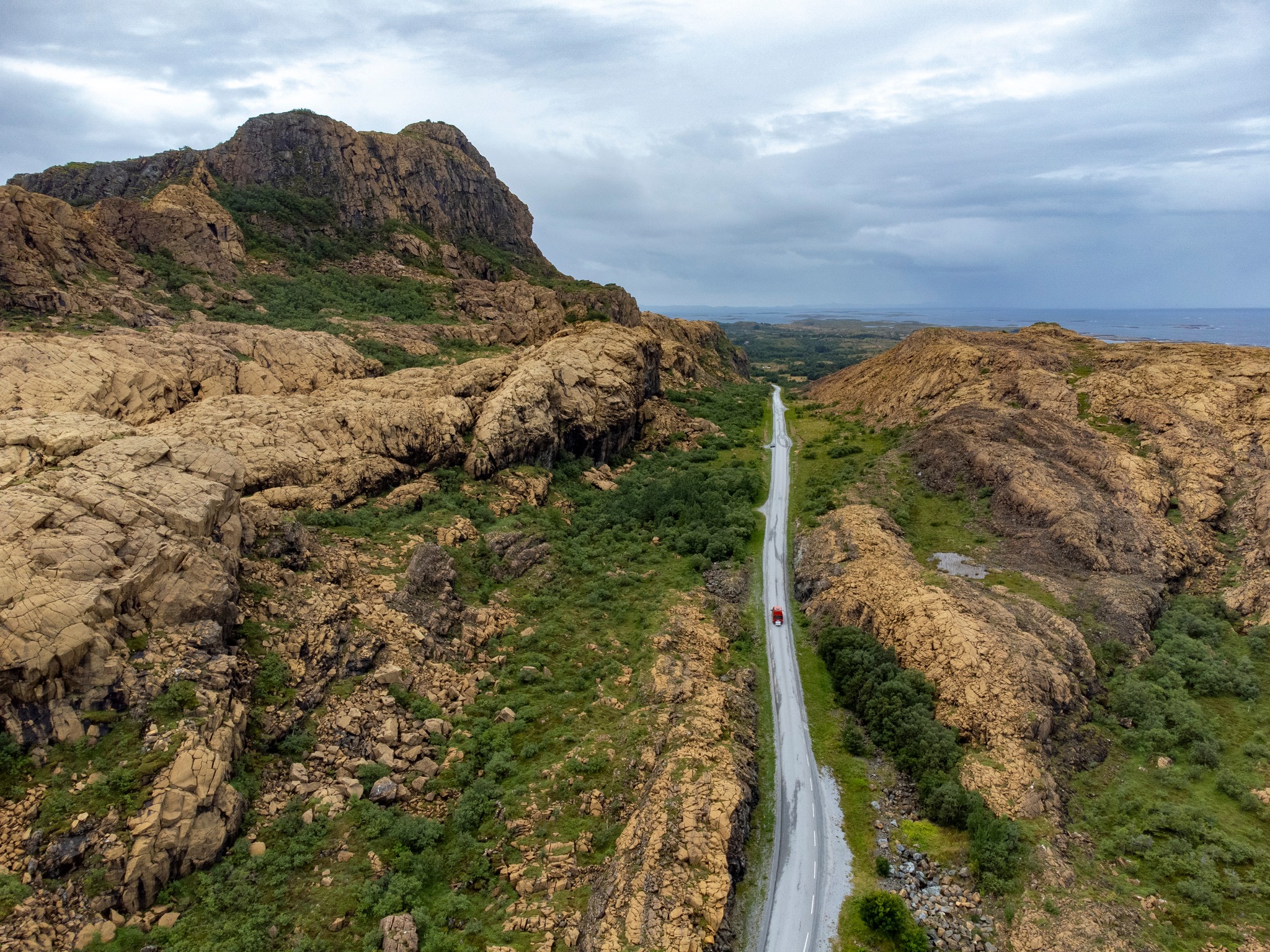
Leka isn’t a big island; you can drive around it in under 30 minutes. Right after we roll off the ferry it seems unremarkable. That changes once we reach the west side. Suddenly we’re looking at something you don’t usually see in Norway.
The island’s western side is made of ophiolites—rocks that usually sit deep beneath the Earth’s crust. They surfaced due to tectonic movements as oceanic crust subducted beneath the continent. The result is a landscape that at times looks more like Mexico or the American Southwest than typical Norway.
Interestingly, similar rocks occur along North America’s East Coast, a reminder of ancient geological processes that once linked these regions.
The contrast on Leka is striking. The west is drier, rockier and visually unusual, while the east has the classic Norwegian feel—greener, softer, calmer. In a small area you’ll find several lakes, rugged, undulating terrain, and we even catch sight of a local waterfall.
There are several maintained hiking trails, shelters and viewpoints. The island’s highest point is Vattind, an accessible summit with views over the island and the surrounding sea.
Facilities are simple but functional—beyond a couple of cafés, a few shops and a quirky mini petrol station, there isn’t much infrastructure. All the more reason to appreciate the roadside shelters. The one we used had a spotless, working toilet, a power outlet and seating.
Interested in this destination? Would you like to visit it with your dog? Check the entry requirements directly in BorderCooler®.
Solsemhula Cave
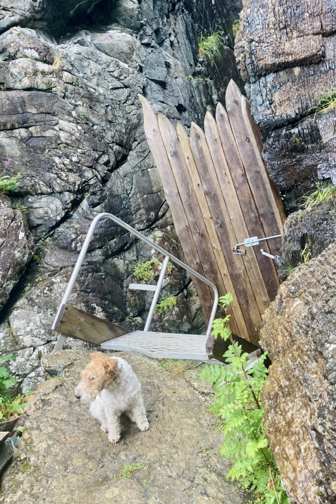
The island is home to Solsemhula Cave—one of Norway’s best‑known archaeological sites. It’s famous for prehistoric rock paintings dating to around 2500 BC. The cave can only be visited on guided tours.
A short path leads from the car park to the cave. I used that short stretch to walk the dog. It’s an easy out-and-back, about 30 minutes in total. The trail is straightforward, though expect damp ground and some muddy patches. Still, it’s safe and perfect for a dog.
The cave entrance was, of course, locked. There’s an information board and, not far from the entrance, a bench with a view of the coast. We didn’t linger; after a quick lunch at the car park we headed back to the harbour and then to the mainland.
Conclusion
Leka was exactly the kind of place I might not have planned on my own. It doesn’t take long to visit, yet it offers an unusual landscape, a fascinating geological story and a sense of calm far from the main tourist routes.