


The plan was simple: get on the mountain bikes, bring Ibo along, and head out from Sološnica to a modest-looking ridge above Čertova dolina that had caught our eye on the map. No big ambitions, no pressure to reach the summit—just to see what the place offers. In the end, though, it turned into a surprisingly demanding push to the top of Vápenná. The conditions were nothing like what we’d counted on.
Vápenná, Roštún National Nature Reserve, Čertova dolina and Orlia skala
Vápenná (752 m a.s.l.) is one of the most distinct peaks in the northern Little Carpathians in western Slovakia. It’s known for its karst terrain—limestone crags, steep slopes and open ridgelines with wide views.
The entire area lies within the Roštún National Nature Reserve, which protects these karst features, rock formations, dry grasslands and rare plant species.
Čertova dolina is one of the lesser-used approaches to the Vápenná massif. It’s a narrow, at times wild valley that has kept a more natural feel than the main hiking routes.
Above the valley rises an unassuming yet compelling ridge studded with rock features. The most prominent is Orlia skala—a solitary block of rock that stands above the surrounding terrain and offers views over the forests and neighbouring hills. That ridge was our original goal.
Going off marked trails here warrants careful consideration. It’s a protected area, and nature—and the rules—deserve respect. On this outing we did leave the waymarked paths in places; choosing to do the same is a personal decision, and the responsibility is yours.
Starting in Sološnica
We set off from the village of Sološnica, from the car park at the end of Slanisko Street. From there we join the green-marked trail heading towards an area known as Obora.
Here we leave the marked trail and traverse meadows beneath the Vápenná massif. This stretch is surprisingly pleasant—open ground, more or less flat, and the first views across the landscape. To our left sit the nearby villages of Sološnica and Plavecké Podhradie; to our right, forests descending from the Vápenná massif.
We gradually reach the U klena spring, where we join a farm track. It swings right and, a few metres later, we’re at the entrance to Čertova dolina.
The ridge above Čertova dolina
Čertova dolina is an appealing destination in its own right, but we opt for a less obvious alternative—a path along its left side.
The path follows a narrow ridge that climbs sharply above the valley. Here we’re pushing more than riding. The terrain is steep, rough and technical. Ibo, however, is clearly in his element.
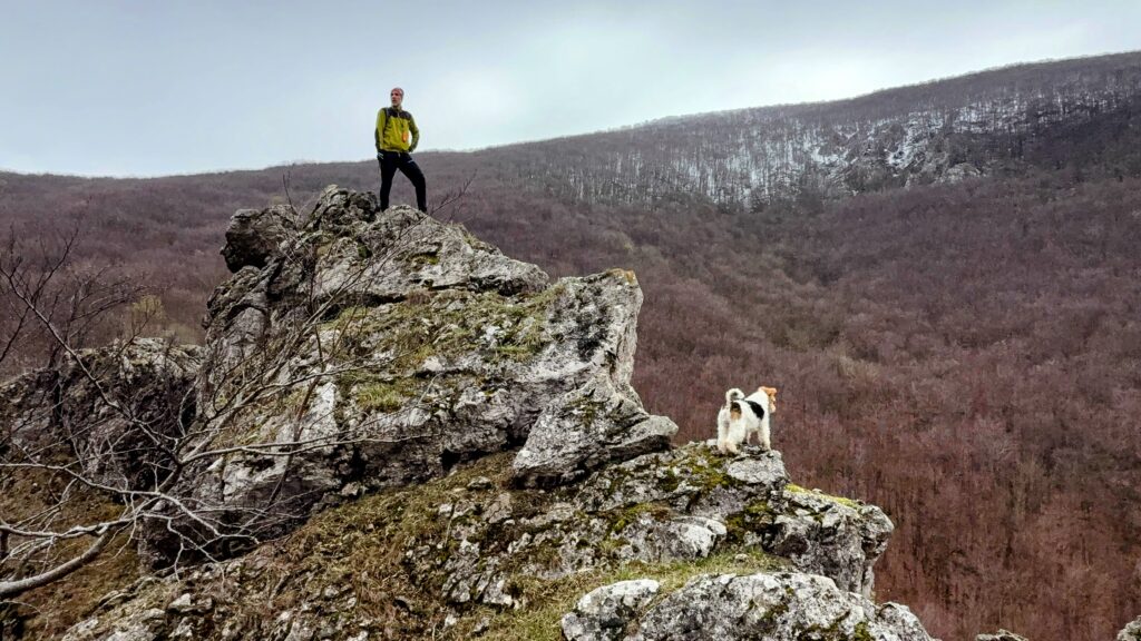
After a few hundred metres the gradient finally eases and we find ourselves tens of metres above the valley floor. The ridge starts to resemble other karst areas of the Little Carpathians—like Klokoč or Kršlenica, for instance.
Low trees, open ground, a grassy crest and, gradually, small rock outcrops. The most striking is Orlia skala, which rises clearly from its surroundings. We pause here for a breather and a few photos.
This is one of the finest sections of the day. The open ridge offers views over the forests below Vápenná and a preview of what awaits if we decide to continue to the summit. Even though it’s late March, the upper slopes are still under snow. It’s clear it won’t be easy. We go for it anyway.
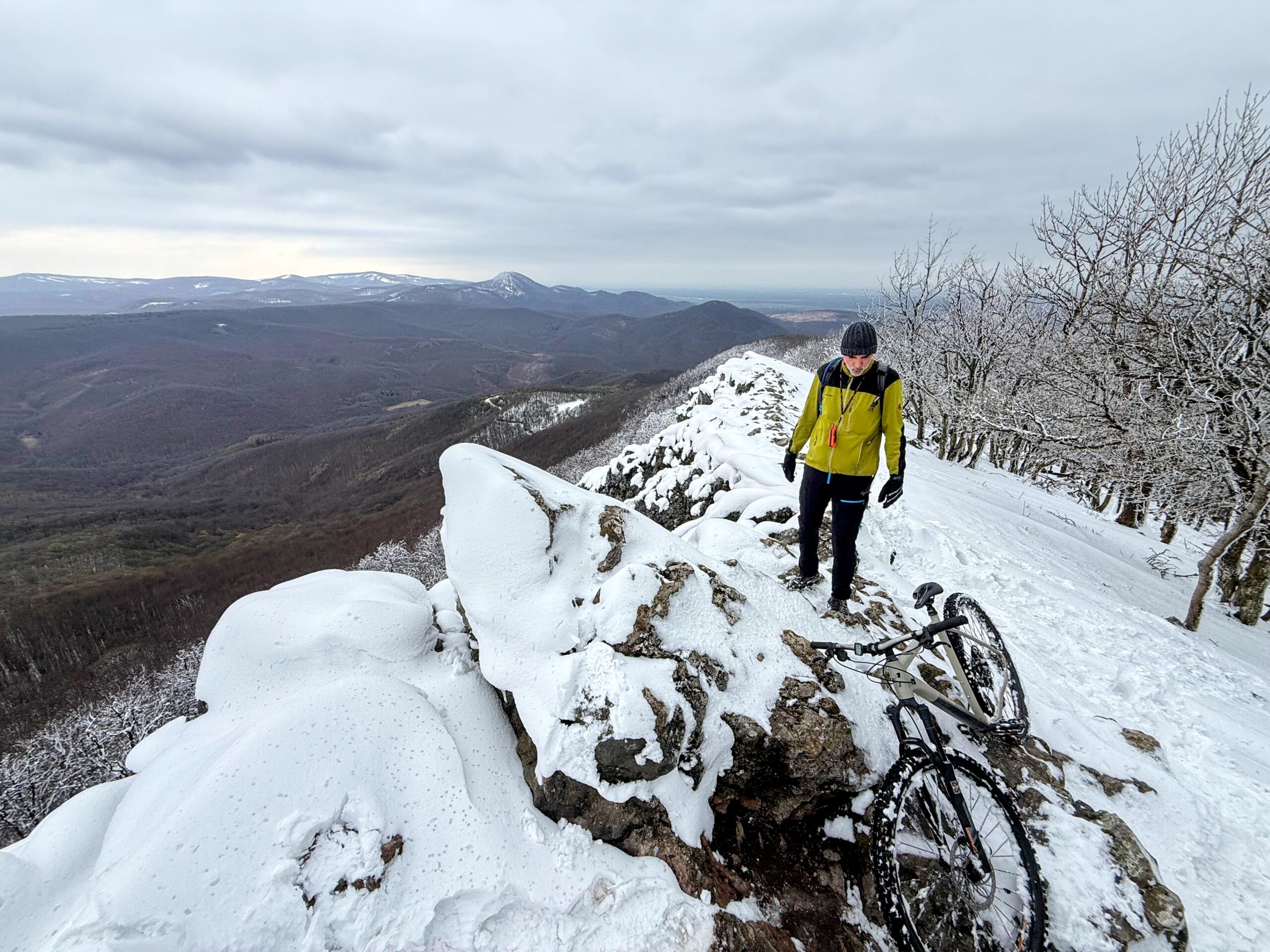
Joining the yellow trail and winter conditions
After a short continuation along the ridge we join the yellow-marked trail. It follows a broad forest road that is still fairly steep. The climb continues to the junction Pod Vápennou.
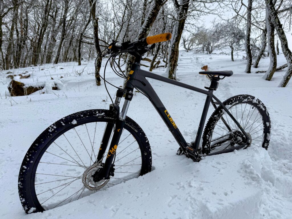
And that’s where the conditions change markedly. The snow deepens, the surface turns slick and riding is no longer realistic. What we could at least grind up before becomes pure pushing. We’re not exactly thrilled.
Ibo, on the other hand, is ecstatic. He’s tearing around in the snow like mad. Snow has always been his favourite element.
The crux of the ascent
Just when it feels like it can’t get any worse, the toughest stretch arrives: roughly 300 metres where the path threads through a tangle of downed trees. Clambering, hauling bikes, deep snow.
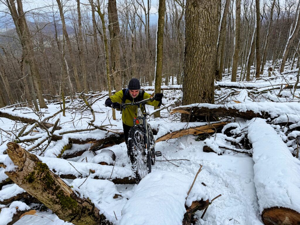
It’s exactly the point where turning back would make perfect sense. We’re too stubborn for that.
To the summit
After a hard slog we finally reach the junction Pod Vápennou.
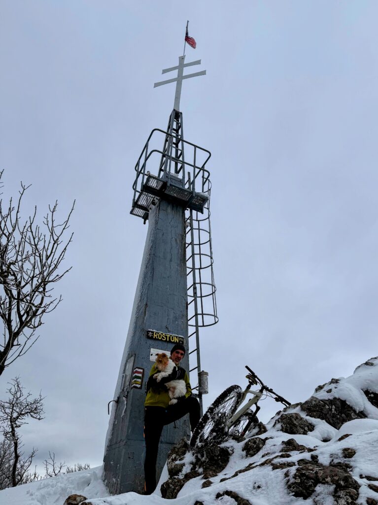
From here it’s only a short hop to the top. There’s probably more snow here than anywhere else on the route, but the goal is in sight. The final metres are more willpower than technique. We meet a few hikers who look at us a little bemused—bikes aren’t a common sight in these conditions.
Our reward is a panorama from the summit across a large swathe of the Little Carpathians. The sun hides behind clouds, but visibility is still good. For this time of year, conditions on top are fairly harsh—wind and cold soon have us moving again. After a brief pause we turn back.
Descent back to Sološnica
The descent is straightforward. We follow the snowy path back to the junction, then pick up the green trail, where at last we’re riding more than walking.
Riding on snow demands focus and is physically tougher. We’re enjoying it, though. As we descend, the snow fades and gives way to mud.
The green trail delivers us straight back to the car park where we started.
Trip summary
Even though we pushed the bikes for much of the route, the outing had real charm. We discovered a beautiful, photogenic ridge above Čertova dolina that’s worth a visit even without the ambition to reach Vápenná’s summit.
The winter conditions on Vápenná tested our fitness as well as our gear.
And Ibo? He probably enjoyed it most of all. At the end he hops into the car, content, and is asleep within minutes. That’s always the best sign it was worth it.
As is often the case, we wrapped up the trip in a nearby restaurant. We stopped at U Radky in the village of Kuchyňa.
From the outside it doesn’t look especially dog-friendly, mainly thanks to a sticker with a crossed-out dog on the door. After a quick chat with the owner they let us in—with Ibo—and we had an excellent lunch. After an effort like that, everything hits the spot—hot food, a draught beer and a few quiet minutes in a pleasant setting. Highly recommended.
Practical information
Loop length: 8.1 km
Elevation gain: 474 m
Type: mountain biking
Difficulty: moderate (high in winter conditions)
Dog-friendly: yes, but for a capable dog (steep sections, snow in winter)
Season: ideally spring–autumn (much tougher in winter)
Gear: plenty of water, sturdy footwear, warm clothing