


On our road trip through Norway, we’ve made it to Bodø. This is where the next little adventure begins. We’re heading for the famous Lofoten archipelago, but unlike most visitors we plan to start with one of its lesser-known islands—Værøya.
We don’t have much time for sightseeing in Bodø, so we head straight for the port. The logistics take a bit of figuring out: as usual there are several car lanes, each for a different ferry and destination. We ask around to make sure we’re in the right place. In the end it’s clear nothing here is left to chance—if you’ve got a ticket, the staff will guide you into the right lane at the right time.
By the way, never heard of Værøya? Until recently, neither had we. Our reason for going is simple and a little unbelievable: if you buy a Bodø – Moskenes ferry ticket but get off at Værøya, the price comes to 0 Norwegian kroner. An offer that’s hard to pass up.
Not all ferries are the same
The crossing from Bodø to the island of Værøy takes about 5.5 hours, and unlike the previous ferries we’d taken in Norway, this one runs on the open sea. That comes with a few quirks we weren’t fully prepared for.
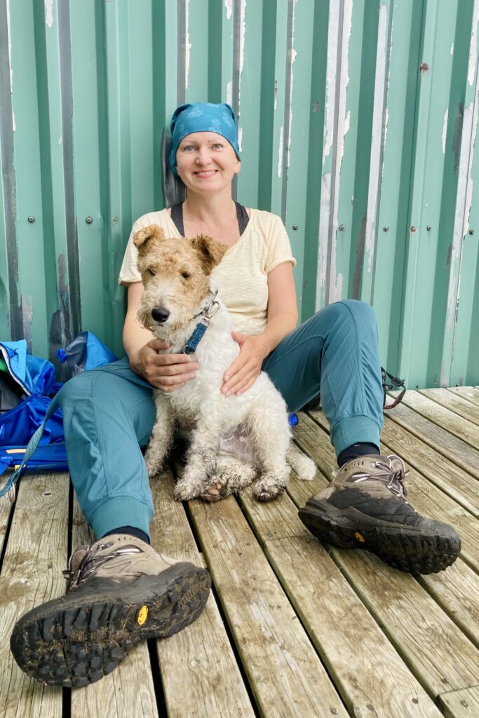
Unlike on most ferries, passengers must leave their cars and move up to the passenger deck; access to vehicles is essentially prohibited during the crossing. It’s trickier with dogs—the deck is off limits and they have to stay in the car the whole time. We still tried to “smuggle” him up for a while; it worked for about an hour before a crew member politely asked us to take him back to the car.
We were told we could check on our dog once an hour in the car, but only with a crew member accompanying us. In practice that was easier said than done—the staff weren’t always available, so we managed to check on him just once during the crossing and once during the stopover on Røst.
Røst: the end of the world
En route the ferry makes a stop at the islands of Røst (also called Røstlandet), the westernmost and southernmost part of Lofoten, almost 50 kilometers from the main chain.
This stretch had a strangely mystical feel. Røst is little more than a handful of rocky stacks in the middle of nowhere. We arrived right at sunset: golden light, open ocean, the silhouettes of the rocks, and the sheer remoteness—an atmosphere that’s hard to put into words.
Only a few people get on or off here. There’s a small fishing village, a few kilometers of road, and a functioning airport. The island is of strategic rather than touristic importance—serving fishing first and foremost, and acting as a key point in the North Atlantic thanks to its position on Norway’s fringe and that working airstrip.
Fun fact: In 2002, the Røst Reef—about 43 kilometers long—was discovered just off Røst, one of the largest cold-water coral reefs in the world.
Where are we?
The sun is setting and we still have more than an hour to go to Værøy, specifically to the harbor in the village of Sørland.
As soon as we disembark, we drive around to scout a few potential camping spots. The best one turns out to be on the island’s north side, at the very end of the road: quiet, peaceful, scenic, and almost empty. The bonus? Public toilets with running water just a short walk from where we sleep.
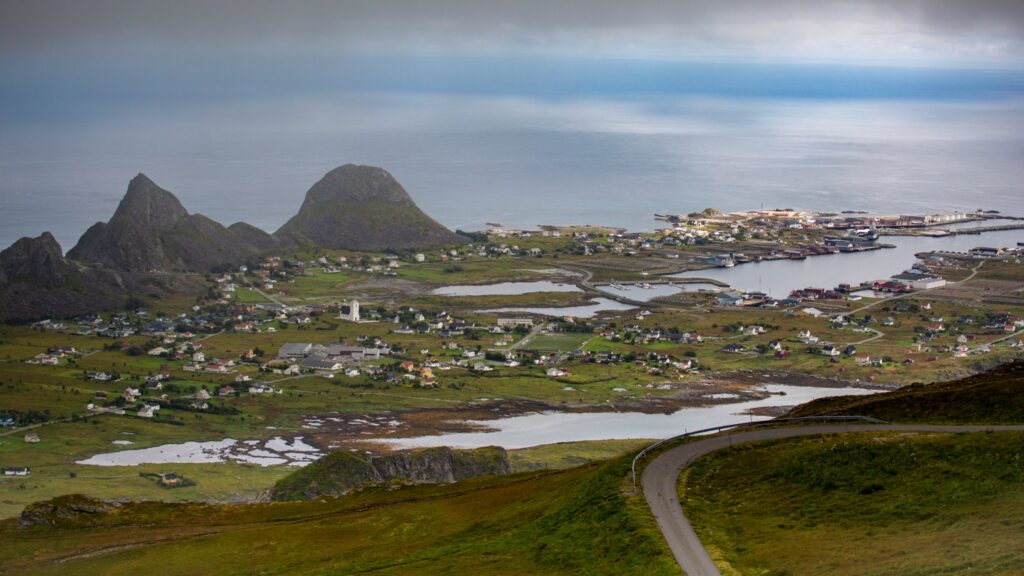
It doesn’t take long to realize how small and compact Værøya really is. It covers about 19 km², with only around 700 inhabitants and essentially just two villages—Sørland and Nordland. The road network runs for only a few kilometers, and everything feels simple, calm, and unhurried.
Even though the sun has long set, it’s still light—the summer sun barely dips below the horizon here. After unpacking and pitching the tent we finally crash, tired from the day. The night is fairly warm and pleasant, interrupted by a few short showers.
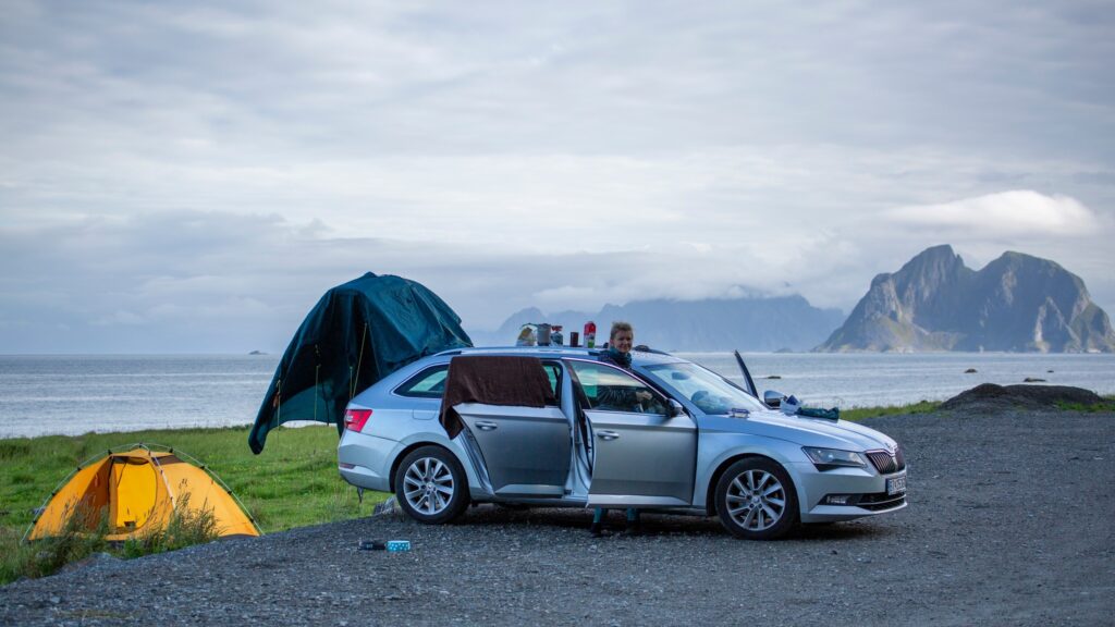
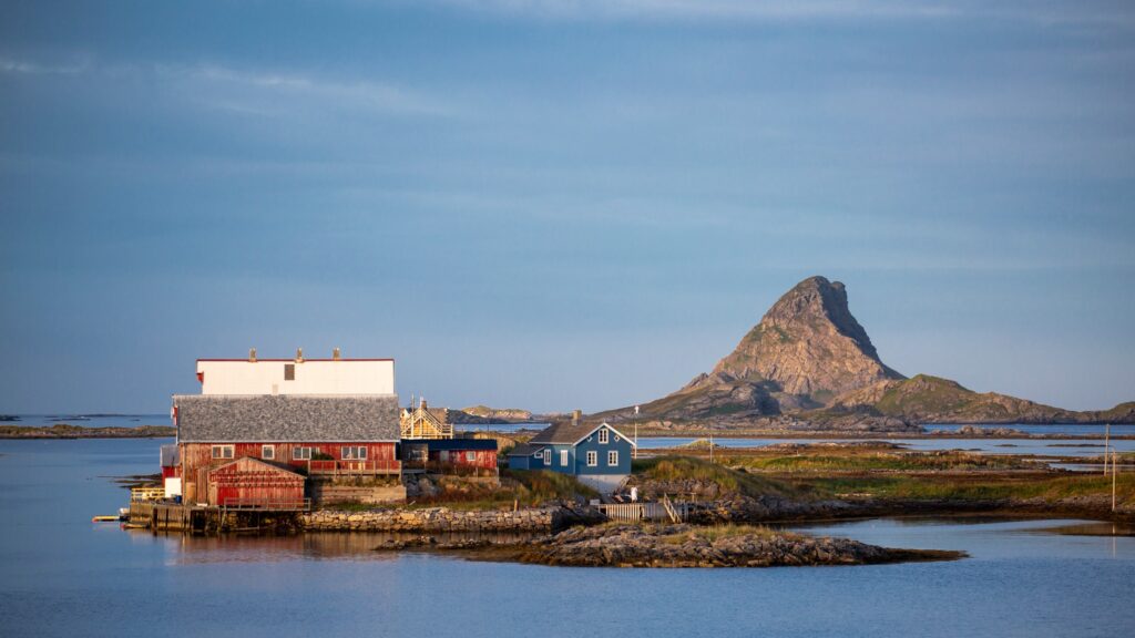
In the morning we dry whatever we can. The car roof turns into a makeshift kitchen, and we have breakfast overlooking the uninhabited island of Mosken.
Close by is a now-disused airstrip, closed because of sudden, unpredictable winds. Today the surroundings make an ideal place to camp.
Håen
Morning brings a slight improvement, but the forecast is relentless—cloud will build through the day. We head back to Sørland and park at a small lot beyond the village, where most hiking trails begin.
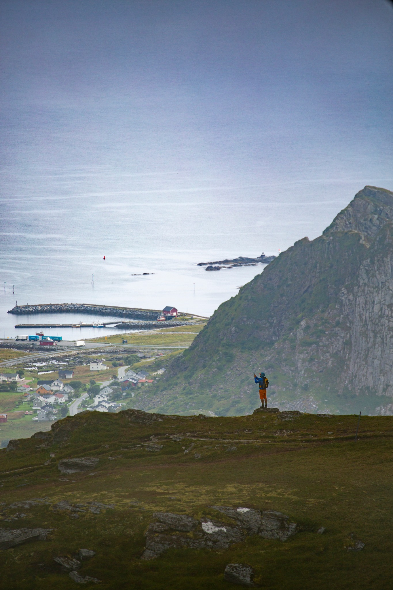
Our goal is Håen (438 m), known for views over the island’s western side. There’s a military radar on top and a service road called Natoveien leading up. “Veien” means “road” in Norwegian, which hints at the origin of the name. The road would make for an easy ascent, but its first section runs through a tunnel in the mountainside, and entering the tunnel—on foot or by car—is prohibited.
The official trail climbs steep grassy slopes before joining the road higher up. The ascent isn’t difficult; the path is maintained and easy to follow even in poorer visibility. After about an hour we top out—only to find thick fog and a military compound. As for views, absolutely nothing.
In good weather, the panoramas from here are sometimes dubbed “Norway’s Nusa Penida”, reminiscent of the view of Kelingking Beach on Nusa Penida in Indonesia.
Along the ridge
We linger on Håen for a while, hoping the clouds might break. It soon becomes clear they won’t, so we carry on.
From Håen we follow the ridge north toward Hornet (346 m). At first we’re still walking in fog, but the weather slowly eases. That’s when we finally grasp what lies to our left: steep, often very exposed cliffs plunging straight into the sea. We put the dog on a leash, just in case.
On the right, by contrast, gentler grassy slopes drop toward Sørland. Only on the descent does the fog finally part and we get at least partial views. In the foreground Hornet shows itself; beyond it lies Mosken, and in the distance the main Lofoten islands.
After the descent we head straight back to Sørland. We’re tired—there’s been a lot of moving around and a hike in changeable weather. We park near the fire station and cook a simple lunch.
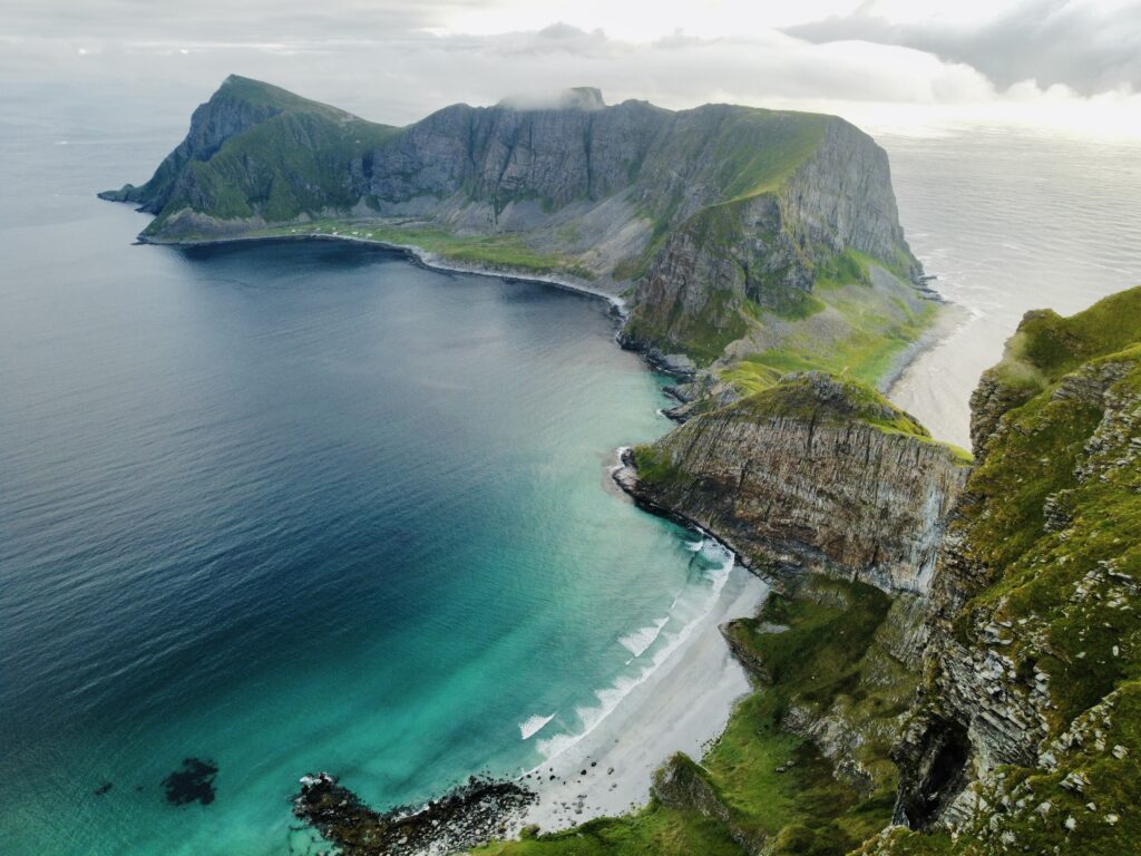
By afternoon the weather is gradually improving, so I take the chance to send up the drone. At first I capture only the immediate surroundings and the military station on Håen’s summit, but as the clouds lift, more distant views open up. I finally manage to photograph the island’s western side, which we’d missed in the fog. From above it’s clear how rugged the coastline is—and that there are several genuinely beautiful beaches.
In the evening we head back to the harbor to wait for the same ferry that brought us here the day before. This time we’re sailing toward the better-known, busier parts of Lofoten.
This detour at the end of the world was worth it. Røst felt mystical even from the ferry, and Værøya is a chapter of its own—hard to pin down, all the more unique. For 0 NOK, it was absolutely worth it.
Interested in this destination? Would you like to visit it with your dog? Check the entry requirements directly in BorderCooler®.