
During our travels through Norway our wheels took us to Jotunheimen National Park. We turn off the main route and head into the Leira valley, where we park at the mountain lodge Leirvassbu. The lodge lies on the boundary of Jotunheimen National Park, at the end of the valley, and is one of the main starting points for hikes in this area. Our goal was the peak Kyrkja (2032 m) – a hill that does not look extreme on the map, but in reality showed us that in this mountain range almost nothing is completely “free”.
Kyrkja is one of the most prominent peaks in the central part of Jotunheimen. Its name translates as “church” – and not by chance. The pointed, steep shape of the summit viewed from the valley resembles a church tower. Although it is not a technically climbing peak, the final part of the ascent is steep and at times exposed, which makes the climb to Kyrkja a proper mountain hike.
Ascent route
We set off from the parking lot by Leirvassbu lodge and the first meters led along a wide track. It brought us to the turnoff for the marked hiking trail JOT34, which heads toward the Olavsbu cabin.
After joining JOT34 the route is initially easy. As we gradually gain altitude the landscape begins to open up – glaciers and extensive mountain massifs appear before us, with surrounding peaks ranging roughly between 2000 to 2400 m a.s.l. The path is well marked and straightforward.
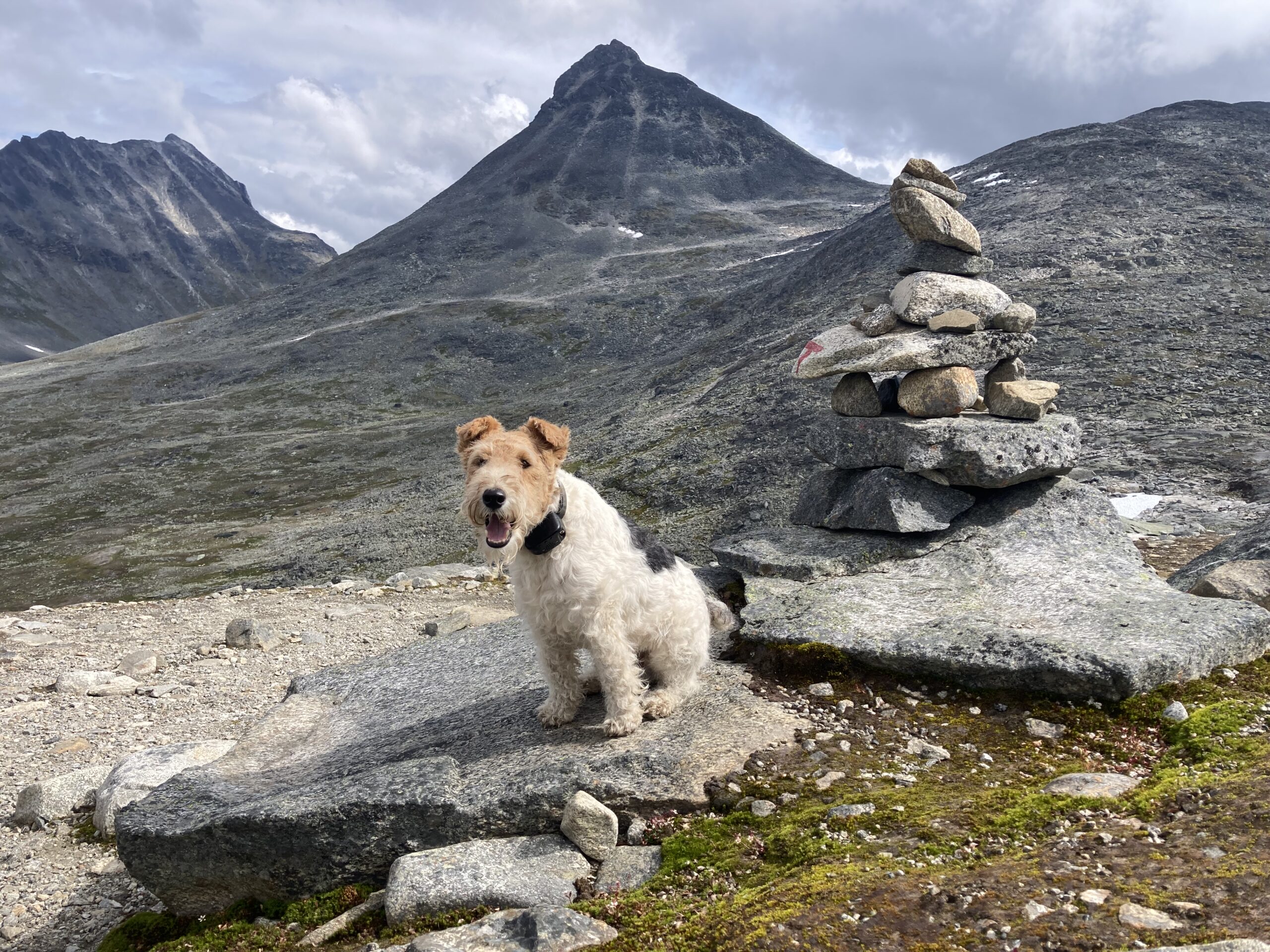
After crossing above the lake and reaching the first wider saddle the character of the route changes. On the left our route branches off – an unmarked path leading directly to the summit of Kyrkja. Here the ascent intensifies markedly and the trail is less distinct, but in good visibility its direction is clear.
As we approach the next saddle below the summit we cross small snowfields. These are remnants of snow that remain here even during the summer months and require sure-footedness.
More complicated finish
In the final saddle the steepness of the last part of the ascent fully reveals itself. The trail turns into rocky terrain where we move between large boulders and rock blocks. The route climbs in short zig-zags. I had to carry the more difficult sections by hand. Unfortunately, we underestimated this hike a bit and did not bring his hiking harness.
Unlike the previous sections, the final vertical meters are surprisingly more exposed. Continuing further with the dog without a hiking harness would be unnecessarily risky, so I proceed alone. Iva with Ibo remain a few meters below the summit. On the next stretches you sometimes need to use your hands. Fortunately it is dry here, no snow, which pleases me. We do not have any winter equipment with us. Despite the difficulty, just below the summit I met a few hikers with their children aged approximately 10–12 years.
At the summit
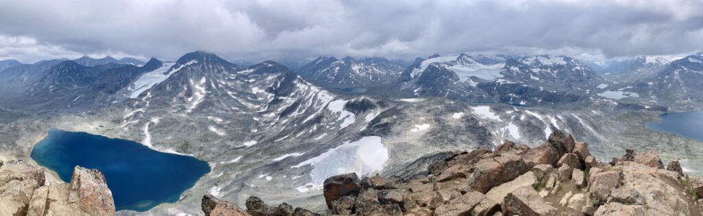
From the summit broad views open up over Jotunheimen and the lake Kyrkjetønnet, which lies deep in the valley directly beneath the peak. Combined with the rocky ridges and distant glaciers, it is one of those views that make the climb worth the effort.
After a few minutes on the summit I turn and return along the same route to Iva and Ibo. Without Ibo’s hiking harness in this more demanding terrain we have only two options – either carry him by hand again, or reorganize things in our backpack and do what we already tried on the descent from Mount Magart: put Ibo into the backpack.
In the end it proved to be a very practical solution. We only take him out of the backpack at the saddle where the trail evens out again.
Conclusion and recommendations
Although the climb to Kyrkja is not among extreme mountain hikes, it should not be underestimated. Especially in the very final section expect steep and at times exposed terrain that requires sure-footedness and the ability to move on rock. In worse weather the difficulty of the hike naturally increases and with reduced visibility orientation problems can occur, since the final part of the route is not officially marked.
We would recommend the hike with a dog more for medium and larger breeds that move more easily in rocky terrain. Even so, it is advisable to have a hiking harness with you or another option to safely carry the dog in the more difficult sections.
When moving with a dog in Jotunheimen National Park it is necessary to observe the official rules. During the main season the dog must be on a leash so as not to disturb wildlife and grazing herds. Respect for nature, other visitors and following the principles of travel in a protected area is of course expected.
Basic facts about Kyrkja and the hike
- Peak name: Kyrkja
- Elevation: 2032 m a.s.l.
- Mountain range: Jotunheimen
- Starting point: Leirvassbu lodge (Leira valley)
- Total length of the hike (round trip): 8.6 km (4–5 hours)