

Vošac (1421 m) is among the most accessible peaks of the range above Makarska, yet it can be extremely demanding in summer — especially if you’re hiking with a dog. It is one of the few clearly recognizable peaks you notice immediately when looking at the Biokovo mountains from the Makarska beaches. Its silhouette is distinct and separate, as if rising directly above the town.
We chose the route from the village of Kotišina above Makarska with a return to the village of Makar. We set off early in the morning, still in the dark. Me with a headlamp, Ibo with his dog’s “night vision.” In summer daytime temperatures for this kind of hike are extremely high and without an early start it wouldn’t make sense.
Starting point: Kotišina above Makarska

From Kotišina the trail practically immediately climbs steeply. The initial meters lead over rocky terrain in switchbacks. The ascent is significant and will test you right away without any “warm-up.”
Before sunrise a local chamois greets us on the trail. I spot it first – it stands a few dozen meters above us, motionless, as if silently measuring us. In the morning twilight it appears almost symbolic, like a guardian of the mountain. By the time Ibo notices it, it’s already long gone among the rocks.
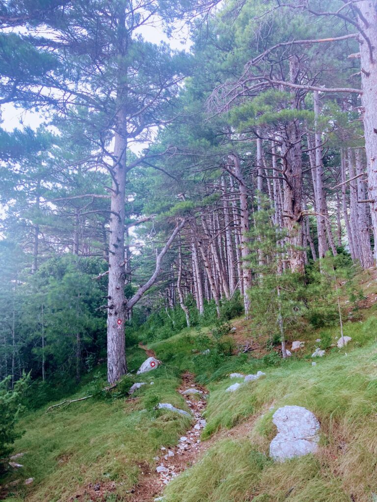
Up to about 750 m above sea level we are in constant ascent. The trail is well marked, straightforward to navigate, but physically demanding. Only at this altitude does the terrain level off a bit for the first time and we enter a more forested section of the route.
This is where my personal battle begins – spider webs. The early morning start means we’re the first on the trail. Webs are stretched across the path and regularly end up right on my face. After a while I grab a branch and hold it in front of me. It’s not elegant, but it works.
At these elevations it begins to get light. The light slowly floods the slopes of Biokovo and the views of the sea. We admire it for a moment, but then continue upward – we want to avoid the midday heat, so we don’t waste time.
Climb to the Biokovo plateau
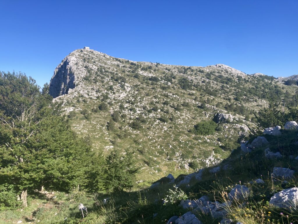
From 750 m a.s.l. we continue up to roughly 1300 m a.s.l. The ascent increases again, and in places the sections are really steep. The forest gradually thins and we reach the Biokovo mountain plateau.
Here the trail no longer climbs so much; it rather traverses and skirts slightly hilly forms toward the Štrbina saddle. The terrain is open, mostly grassy. We definitively leave the shade provided by the Biokovo massif and for the rest of the day the sun more or less continuously shines on us.
Water management
I took just over three liters of water for the hike. At every break I offer water to Ibo from a bowl, but he usually refuses. I gradually notice he drinks more when I give him water directly from the hose of my camelbak. This method works great, but has one disadvantage — it causes fairly large water losses. Some spills out, some ends up on Ibo, some on the ground. And this is where I begin to realize the first problem — the amount of water I thought sufficient might not be enough.
From the Štrbina saddle off-trail to the summit
From the Štrbina saddle we continue directly off the marked route toward Vošac. The summit is already in sight, but the sun is getting strong and the climb becomes steep again. I know we still have a long way back and that the temperature will rise as we descend.
To save Ibo energy, I pick him up and carry him for the last few meters. I have the feeling he sincerely appreciated the gesture. A few minutes later we stand on the summit.
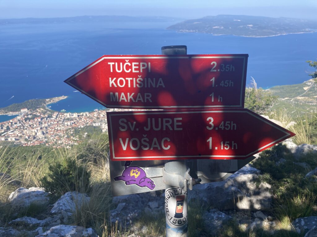
Vošac summit (1421 m)
The summit is spacious and there is also a mountain hut called Planinarski dom ‘Toni Roso’. The views are exactly what you expect from Biokovo — the Makarska Riviera below us, the sea and islands on the horizon. Brač dominates the most. On the opposite side the peak Sveti Jure with its transmitter on top is outlined. It is the highest peak of this range.
I try to launch the drone, but after a few minutes a sleepy hiker runs out of the hut and politely asks me not to buzz the drone here — people are still sleeping in the hut. I understand. Because we set off early in the morning, we’re up here at a time when ordinary people are still asleep. So the drone lands and we start preparing to return.
Descent to the village of Makar: the shortest option
I look at the map and assess the situation — in this temperature it makes sense to choose the shortest route back to civilization. From the Štrbina saddle we therefore descend straight down to the village of Makar.
Although it’s the shortest option, the descent still takes us about two hours. Somewhere halfway down we definitively run out of water.
The next hour is tough. We descend in extremely hot weather without water. There is nowhere to refill. Occasionally I cross dry stream beds, but it’s so dry that looking for water here makes no sense.
Part of the route runs through forest, which at least partially provides shade. However, the end of the trail is open again and the sun is merciless. To my surprise Ibo handles the descent very well even in these conditions. Still, I start to feel sorry for him and already consider in my head ways to get to some water. But the view around suggests that it’s almost impossible.
Water only in Makar
Relief only comes in the village of Makar itself. By the local little church I find a hose with water. I fill Ibo’s bowl. He drinks and drinks and drinks. He can’t stop.
That’s the moment I realize that just as I struggled with the lack of water, Ibo too apparently suffered in the last minutes, even though he didn’t show it. I call Iva and arrange a lift. In a while she’s with us. We get into the air-conditioned car and move to the apartment. Me straight into the pool, Ibo into a room with pleasant air conditioning.
Practical recommendations for ascending Vošac with a dog
Water is absolutely crucial here. There is no reliable water source on the route, especially in summer. Bring more water than you think you’ll ever need.
An early morning start is not just a recommendation, it’s a necessity. After nine or ten o’clock the temperature rises sharply.
The route is well marked and not technically demanding, but it is physically taxing. The steep ascent from Kotišina and open sections without shade can quickly sap your energy.
If you’re going with a dog, realistically consider its fitness, heat tolerance and your ability to carry it if needed. I highly recommend a hiking harness for the dog. Smaller breeds may have trouble on the steep sections and will likely need your help. During our hike we essentially met no one; the trail belonged only to us. A leash was not necessary during the whole trip.
Vošac is a beautiful viewpoint peak with fantastic panoramas. But in summer it is not an “easy morning stroll.” For us it was a powerful experience — but also a hard lesson in water planning.
Basic facts about the hike
- Total route length: 11.8 km
- Duration: approximately 6–7 hours (including breaks)
- Elevation gain: approximately 1200 m
- Difficulty: high (long and steep ascents, minimal shade)
- Suitable for a dog: yes, but only for a physically prepared dog and with a sufficient water supply
- Starting point: Kotišina above Makarska
- Descent destination: the village of Makar
- Water source on the route: not reliable