
An early summer ascent to the summit of Cima di Terrarossa (2420 m) was one of those days when you once again remember why you love the mountains. The combination of an early morning, silence, the lingering winter at the end of June, and the presence of a dog makes such hikes a powerful experience that’s hard to describe in a single sentence.
Transfer to Sella Nevea
We drove from the village of Log pod Mangartom, crossed the border and continued to the Italian mountain village of Sella Nevea. From there we took a steep paved road up to the parking lot below the Rifugio Giacomo di Brazzà hut, which is located at approximately 1500 m a.s.l.
Already at the car it was clear we were in for a proper mountain day. We had over 900 meters of elevation to the summit and a fairly steep ascent.
When your dog says ‘no’
Ibo didn’t look enthusiastic at all in the morning. With intense disobedience and constantly returning to the car he made it clear that he wasn’t in the mood for any adventure. The first meters of the ascent thus proceeded with slight tension and the question of whether we had chosen this goal too optimistically.
Everything changed after about thirty minutes of walking when we reached Rifugio Giacomo di Brazzà. From this point the trail started to climb more noticeably and that apparently woke Iba.
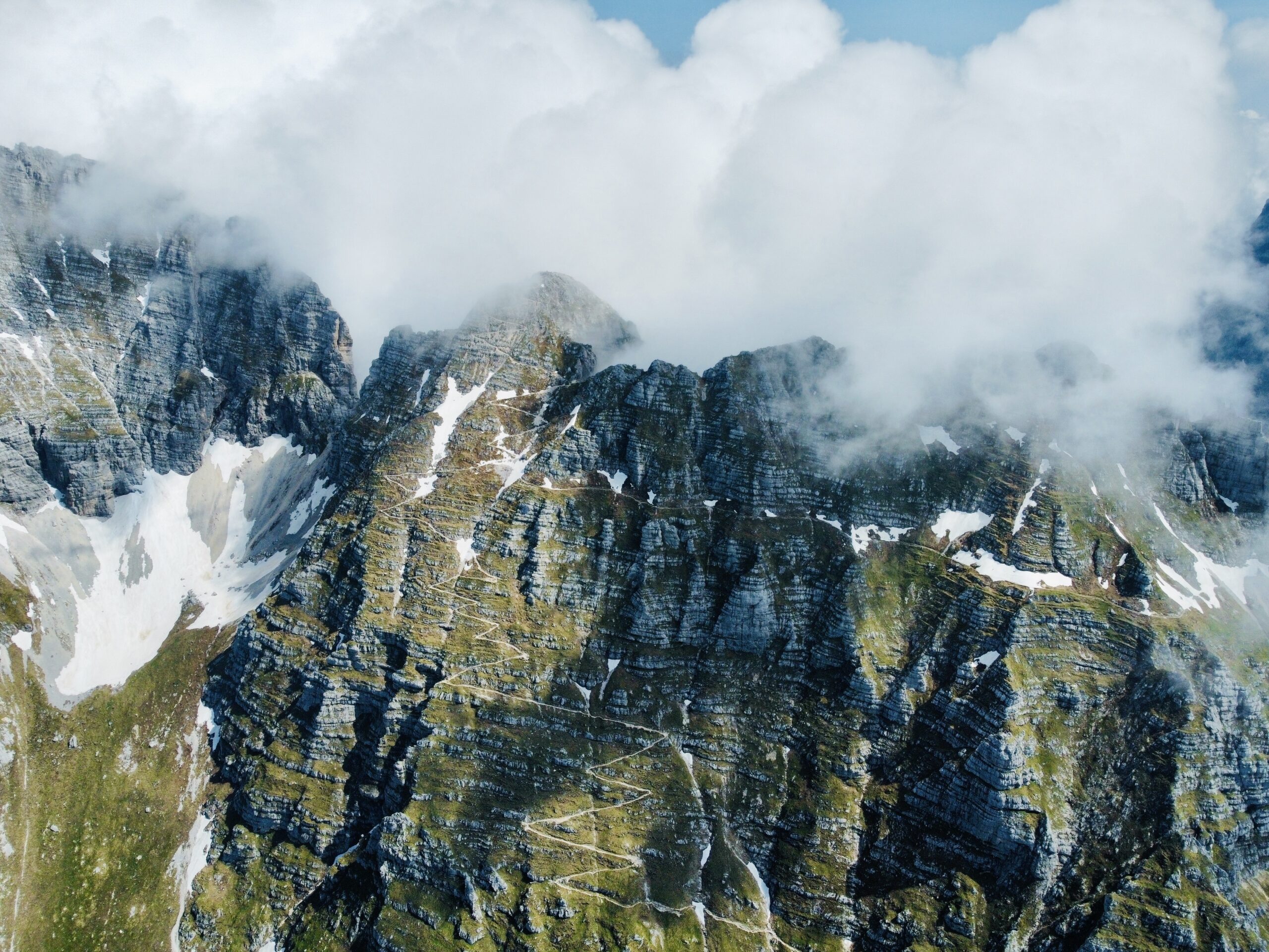
Endless switchbacks
After another roughly twenty minutes the trail bent into steep switchbacks on a relatively steep slope. The continuation of the route was often a mystery – from below you couldn’t see where the path led. Each subsequent switchback, however, always revealed a logical continuation.
And there were plenty of those switchbacks. We were here early in the morning, so we walked completely alone. Only local chamois kept us company and occasionally a marmot called.
Forca di Terra Rossa saddle
We gradually approach the Forca di Terra Rossa saddle (2349 m). In the final sections below the saddle the first snow from the past winter appears. There isn’t much of it and it can be easily bypassed.
The saddle itself is fairly unremarkable and the views are still limited. It was here that the first hiker of the day caught up with us – an older gentleman from Italy. We communicated with gestures and quickly discovered we had the same destination. He is a bit faster, so we let him go ahead.
End of the ascent and the summit
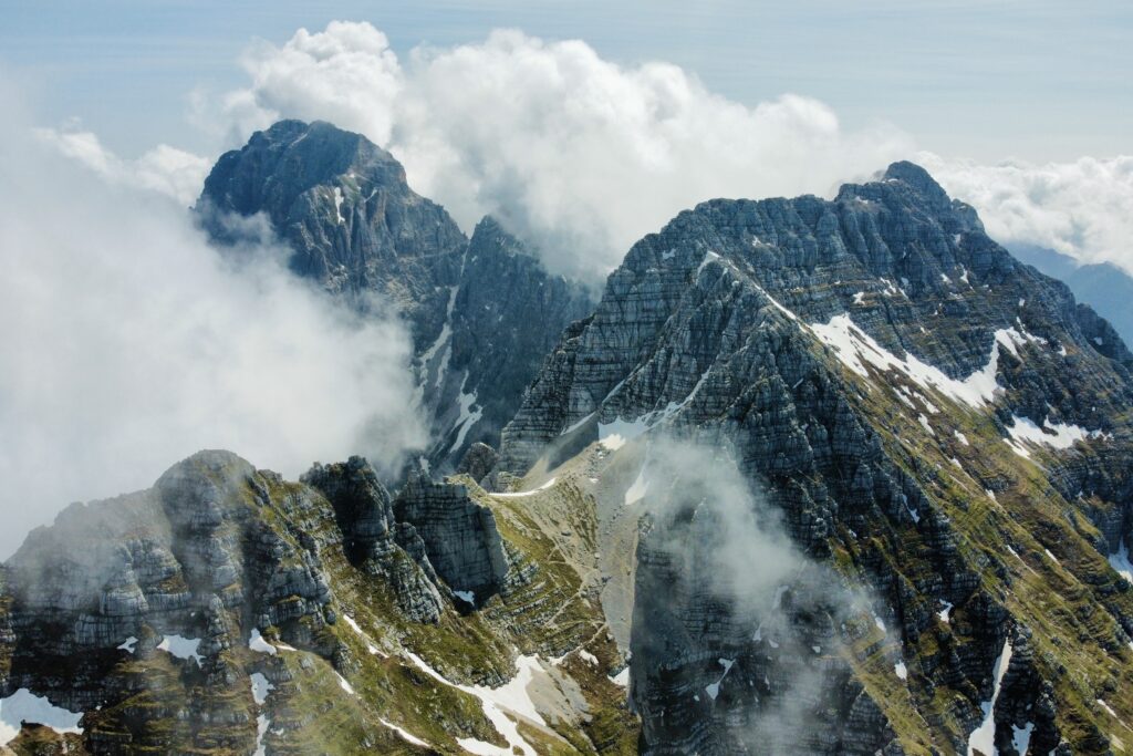
As we climbed higher the amount of snow increased and some sections were already entirely covered by a white blanket. Fortunately the terrain isn’t too steep and progress remains safe.
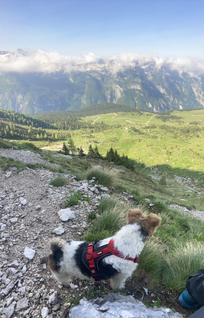
The summit of Cima di Terrarossa is already in sight and the views gradually open up. The first clouds do appear, exactly as the weather forecast predicted, but it’s clear we’ll manage to get ahead of them. And so it happened.
At the summit I enjoy the views from this new place for me. Ibo lies down in the grass and rests. I pull out the drone and take several shots from a bird’s-eye perspective. We spend just under half an hour at the summit.
Return
Finally we pack our backpack and return the same way. Just as the ascent tested us on the way up, the descent goes significantly better. Before we know it we’re standing by the car again, and we sit in it with a good feeling and head back to our accommodation.
Practical notes for the hike
The route to Cima di Terrarossa is technically undemanding and very suitable even for a medium or large dog. Except for the final sections near the Forca di Terra Rossa saddle and the summit itself, it does not contain exposed sections. We recommend using a hiking leash and, of course, a hiking harness for the dog.
The only factor that can complicate the ascent is snow or ice, especially in early summer. Therefore it’s definitely worth checking the current conditions on the route before the hike.
Cima di Terrarossa is a beautiful destination for those looking for a proper mountain ascent and well-deserved views — and at the same time a route that a dog can handle.
Facts about the hike
- Summit: Cima di Terrarossa (2420 m a.s.l.)
- Mountain range: Julian Alps (Julian Alps)
- Elevation gain: approximately 900–950 m
- Ascent and descent time: approximately 6 hours (there and back)
- Start: parking lot below the Rifugio Giacomo di Brazzà hut (approx. 1500 m a.s.l.)